Latitude: 52.6037 / 52°36'13"N
Longitude: 1.7266 / 1°43'35"E
OS Eastings: 652434
OS Northings: 307180
OS Grid: TG524071
Mapcode National: GBR YQY.RBT
Mapcode Global: WHNVZ.HTD9
Plus Code: 9F43JP3G+FJ
Entry Name: 26 and 27, South Quay
Listing Date: 5 August 1974
Grade: II
Source: Historic England
Source ID: 1245804
English Heritage Legacy ID: 468630
ID on this website: 101245804
Location: Great Yarmouth, Norfolk, NR30
County: Norfolk
District: Great Yarmouth
Electoral Ward/Division: Nelson
Parish: Non Civil Parish
Built-Up Area: Great Yarmouth
Traditional County: Norfolk
Lieutenancy Area (Ceremonial County): Norfolk
Church of England Parish: Great Yarmouth
Church of England Diocese: Norwich
Tagged with: Building
GREAT YARMOUTH
TG5207SW SOUTH QUAY 839-1/15/179 (North East side) 05/08/74 Nos.26 AND 27
GV II
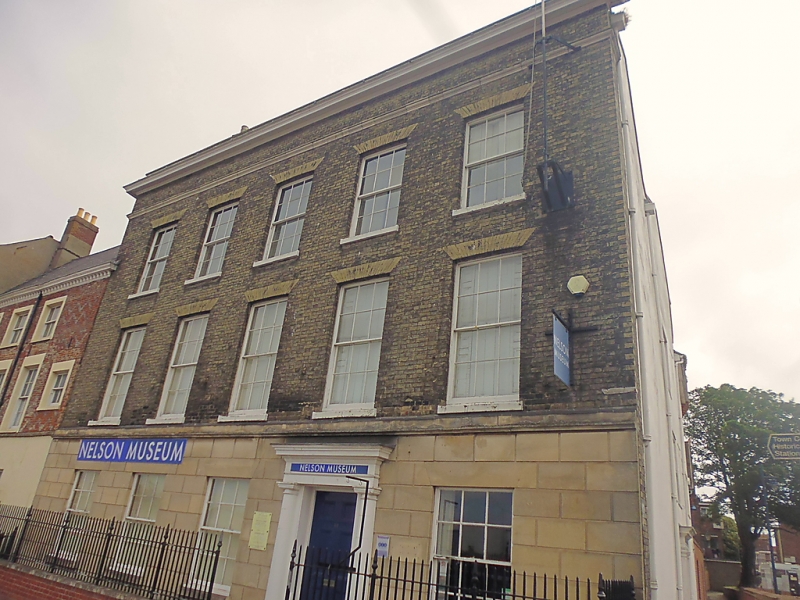
Pair of houses. C17 origins, facade rebuilt in mid C19 and divided into 2 properties by 1874, damaged by bombs 1942 and rebuilt 1948. Internal partitions inserted for use as offices mid C20. Gault brick. Sloping felt roof. 3 storeys; 5-window range. The ground floor rendered and scored to imitate ashlar blocks. 6-panelled door set right of centre with a doorcase composed of unfluted Doric columns supporting a plain entablature and hood. One 6/6 unhorned sash right and 3 to left of door. The 2 upper floors each have five 6/6 unhorned sashes under gauged skewback arches. Parapet. Stack to north. 3-storey rear wing is rendered. INTERIOR: principal rooms have plaster round arches. First-floor front room with a modillion and rosette cornice. Front rooms on upper floors now contiguous with No.25 to north (qv).
Listing NGR: TG5243407180
External links are from the relevant listing authority and, where applicable, Wikidata. Wikidata IDs may be related buildings as well as this specific building. If you want to add or update a link, you will need to do so by editing the Wikidata entry.


Other nearby listed buildings