Latitude: 52.6038 / 52°36'13"N
Longitude: 1.727 / 1°43'37"E
OS Eastings: 652458
OS Northings: 307193
OS Grid: TG524071
Mapcode National: GBR YQY.RG2
Mapcode Global: WHNVZ.HTL7
Plus Code: 9F43JP3G+GQ
Entry Name: 6, 7 and 8, Row 111
Listing Date: 26 February 1998
Grade: II
Source: Historic England
Source ID: 1245916
English Heritage Legacy ID: 468603
ID on this website: 101245916
Location: Great Yarmouth, Norfolk, NR30
County: Norfolk
District: Great Yarmouth
Electoral Ward/Division: Nelson
Parish: Non Civil Parish
Built-Up Area: Great Yarmouth
Traditional County: Norfolk
Lieutenancy Area (Ceremonial County): Norfolk
Church of England Parish: Great Yarmouth
Church of England Diocese: Norwich
Tagged with: Building
GREAT YARMOUTH
TG5207SW ROW 111 839-1/15/155 (North West side) Nos.6, 7 AND 8
GV II
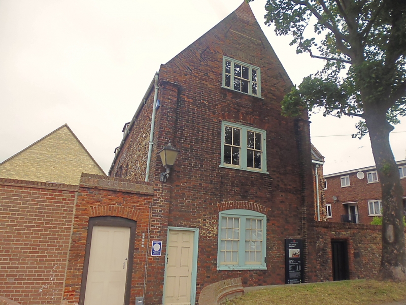
House, converted to tenements C19, roof and upper part damaged by bombing 8 April 1942; now used as a museum. Early C17 house extended to the south in the late C17, when the east wing was added. Knapped flint and brick. Plain-tiled roofs. 2 storeys and dormer attic; 4-window range. West front has a central west door in a bolection-moulded doorcase flanked by 2 sashes and replica 2-light cross casements each side. 4 similar first-floor windows. Gabled roof with 2 sloping dormers fitted with C20 casements. Internal gable-end stack to north with a single octagonal flue, truncated. Truncated ridge stack right of centre. INTERIOR: bridging beams with sunk quadrant mouldings are normal. North ground-floor room with C18 large-framed panelling. First floor east window with a king mullion. Scheduled Ancient Monument.
Listing NGR: TG5245807193
External links are from the relevant listing authority and, where applicable, Wikidata. Wikidata IDs may be related buildings as well as this specific building. If you want to add or update a link, you will need to do so by editing the Wikidata entry.


Other nearby listed buildings