Latitude: 53.389 / 53°23'20"N
Longitude: -1.4684 / 1°28'6"W
OS Eastings: 435455
OS Northings: 388147
OS Grid: SK354881
Mapcode National: GBR 9HG.QY
Mapcode Global: WHDDP.F20R
Plus Code: 9C5W9GQJ+HM
Entry Name: Borough Bridge
Listing Date: 12 December 1995
Grade: II
Source: Historic England
Source ID: 1247312
English Heritage Legacy ID: 456681
ID on this website: 101247312
Location: Kelham Island, Sheffield, South Yorkshire, S3
County: Sheffield
Electoral Ward/Division: City
Parish: Non Civil Parish
Built-Up Area: Sheffield
Traditional County: Yorkshire
Lieutenancy Area (Ceremonial County): South Yorkshire
Church of England Parish: Pitsmoor Christ Church
Church of England Diocese: Sheffield
Tagged with: Bridge
SHEFFIELD
SK3588SW CORPORATION STREET 784-1/15/226 Borough Bridge
II
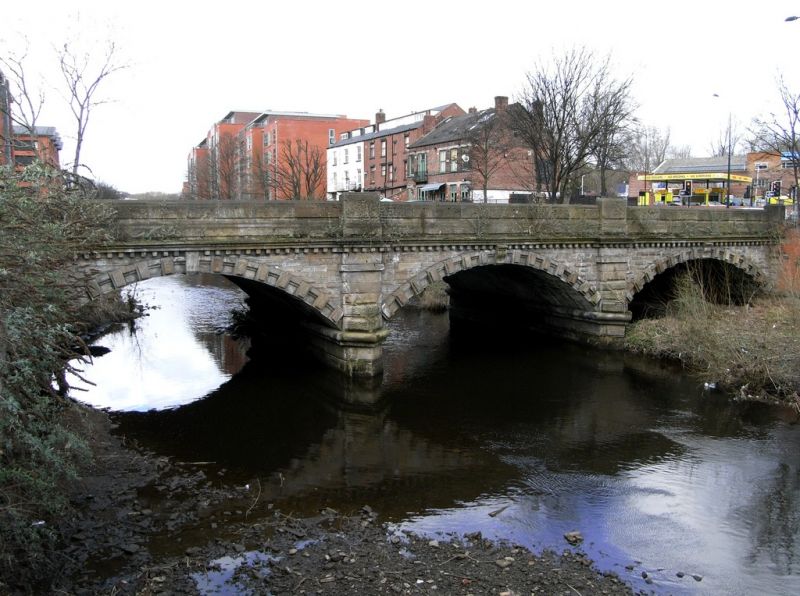
Road bridge spanning the River Don. 1856. Ashlar. 3 segmental arches with heavily rusticated voussoirs and keystones, and pointed cutwaters. Dentilled string course. Rock-faced parapet wall with moulded top and panelled pedestals with chamfered tops. Part of the same development as Corporation Street itself.
Listing NGR: SK3545588147
External links are from the relevant listing authority and, where applicable, Wikidata. Wikidata IDs may be related buildings as well as this specific building. If you want to add or update a link, you will need to do so by editing the Wikidata entry.


Other nearby listed buildings