Approximate Location Map
Large Map »
Latitude: 53.9123 / 53°54'44"N
Longitude: -0.2994 / 0°17'57"W
OS Eastings: 511802
OS Northings: 447574
OS Grid: TA118475
Mapcode National: GBR VRB6.Z9
Mapcode Global: WHHFY.CXNN
Plus Code: 9C5XWP62+W6
Entry Name: Market Cross
Listing Date: 26 November 1985
Grade: II
Source: Historic England
Source ID: 1249470
English Heritage Legacy ID: 431474
ID on this website: 101249470
Location: Brandesburton, East Riding of Yorkshire, YO25
County: East Riding of Yorkshire
Civil Parish: Brandesburton
Built-Up Area: Brandesburton
Traditional County: Yorkshire
Lieutenancy Area (Ceremonial County): East Riding of Yorkshire
Church of England Parish: Brandesburton St Mary
Church of England Diocese: York
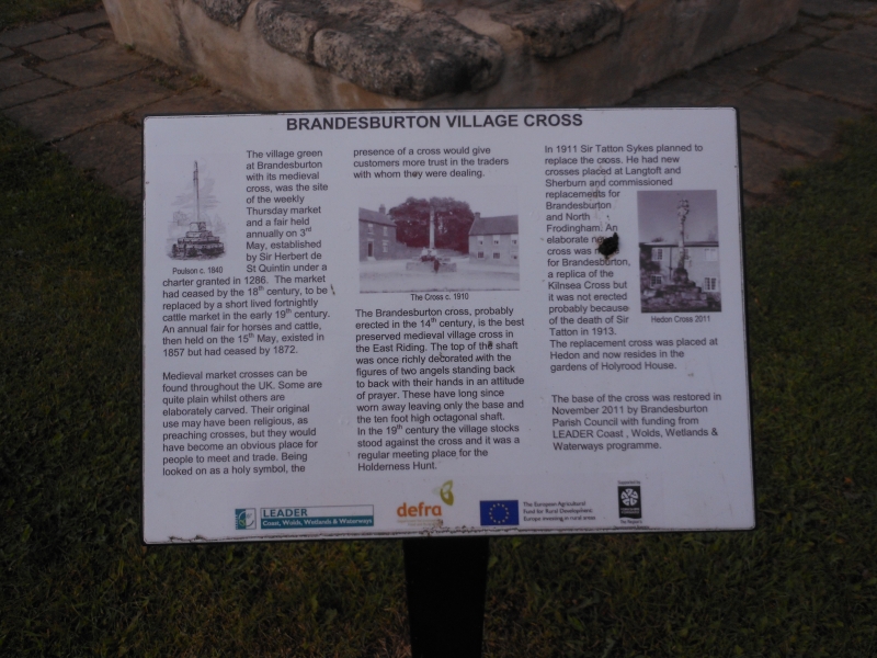
TA 14 NW BRANDESBURTON CROSS HILL
(west side)
5/14 Market Cross
- II
Market Cross. Mediaeval. Three steps and cubic base to tapering
octagonal shaft surmounted by crocketed finial. Scheduled as an Ancient
Monument.
Listing NGR: TA1180347574
External links are from the relevant listing authority and, where applicable, Wikidata. Wikidata IDs may be related buildings as well as this specific building. If you want to add or update a link, you will need to do so by editing the Wikidata entry.


Other nearby listed buildings
