Latitude: 51.4385 / 51°26'18"N
Longitude: -0.1197 / 0°7'10"W
OS Eastings: 530790
OS Northings: 172730
OS Grid: TQ307727
Mapcode National: GBR FY.4J0
Mapcode Global: VHGRC.W33L
Plus Code: 9C3XCVQJ+94
Entry Name: Church of St Margaret
Listing Date: 27 March 1981
Grade: II
Source: Historic England
Source ID: 1249571
English Heritage Legacy ID: 431737
Also known as: St Margaret's Church, Streatham Hill
ID on this website: 101249571
Location: St Margaret's Church, Streatham Hill, Lambeth, London, SW2
County: London
District: Lambeth
Electoral Ward/Division: Streatham Hill
Parish: Non Civil Parish
Built-Up Area: Lambeth
Traditional County: Surrey
Lieutenancy Area (Ceremonial County): Greater London
Church of England Parish: Streatham Hill St Margaret
Church of England Diocese: Southwark
Tagged with: Church building
BARCOMBE AVENUE SW2 1. (north side) 5023 Church of St Margaret TQ 3072 30/371
II
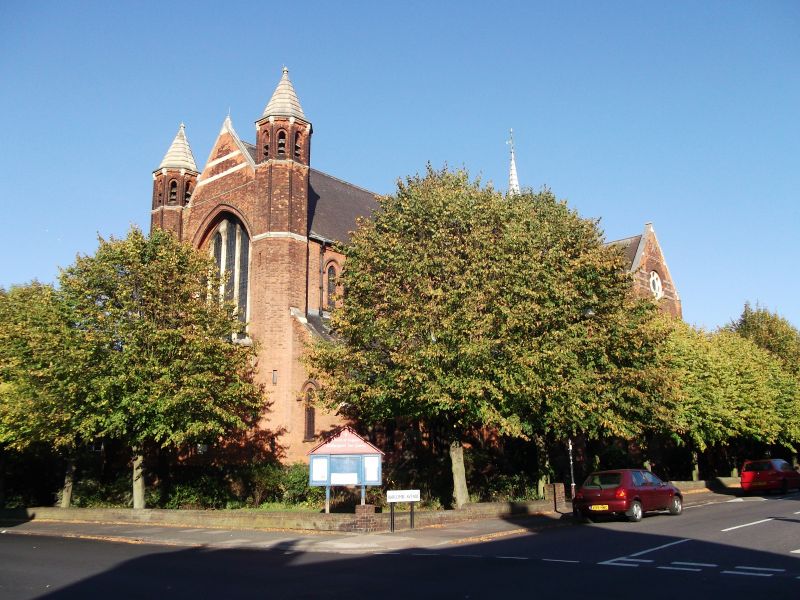
2. Tall church of red brick with stone dressings. Nave has octagonal west turrets with spirelets, low pent aisles, north end south gabled porches. Low, canted baptistery projection at west. Tall, gabled transepts; chancel with short gabled Lady Chapel to south and organ chamber to north. High-pitched tiled roofs with bell-turret at crossing. Austere interior has 5-bay nave with piers of new red sandstone. Timber roof with ogee curved braces. Ornate pulpit with sounding board. Marble lined sanctuary with mosaic floor. Wood reredos dated 1909, possibly Flemish, with panels of crucifixion, Christ in Majesty, saints and bishops.
Listing NGR: TQ3079072730
External links are from the relevant listing authority and, where applicable, Wikidata. Wikidata IDs may be related buildings as well as this specific building. If you want to add or update a link, you will need to do so by editing the Wikidata entry.


Other nearby listed buildings