Latitude: 51.2411 / 51°14'27"N
Longitude: 0.5155 / 0°30'55"E
OS Eastings: 575687
OS Northings: 152104
OS Grid: TQ756521
Mapcode National: GBR PRL.553
Mapcode Global: VHJML.W2DF
Plus Code: 9F326GR8+C6
Entry Name: The Old Vicarage
Listing Date: 26 February 1987
Grade: II
Source: Historic England
Source ID: 1250400
English Heritage Legacy ID: 432733
ID on this website: 101250400
Location: Loose, Maidstone, Kent, ME15
County: Kent
District: Maidstone
Civil Parish: Loose
Built-Up Area: Maidstone
Traditional County: Kent
Lieutenancy Area (Ceremonial County): Kent
Tagged with: Clergy house
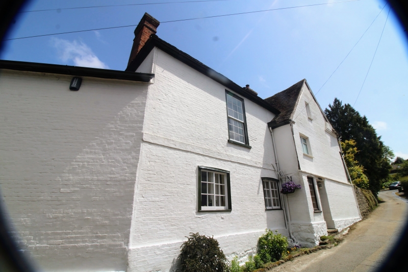
CHURCH STREET TQ 7552 LOOSE (East Side) 6/170 The Old Vicarage 25.7.52 GV II Formerly vicarage, now house. 1657, with C18 and early C19 additions. Main range timber framed, clad with channelled render to first floor. part painted brick part render to ground floor. Plain tile roof. Symmetrical lobby entry plan, built at right-angles to street. 2 storeys and attics on stone plinth. Central multiple brick ridge stack. 2 scarcely jettied gabled eaves dormers spanning all but central section of front elevation, each with small 2-light leaded casement. Irregular fenestration of one 3-light leaded casement below each dormer. Central rendered porch with gable rising to eaves of main range, and with blocked doorway. Boarded door towards rear of left gable. C18 addition to rear to left; painted brick on stone plinth, with plat band, moulded wooden eaves cornice and hipped plain-tile roof. One 18-pane first-floor sash to left side (to road) and 2 horizontally-sliding sashes to ground floor. Early C19 addition infilling re-entrant angle to right; painted brick on stone plinth, with hipped slate roof. Two 12-pane sashes to right side with iron balconettes. Venetian shutters to ground floor windows. Doorway with moulded architrave in shallow rendered porch, towards junction with main range. Interior not inspected. Dated 1657 in parish records (R. Thornburgh; Exploring Loose Village, 1978).
Listing NGR: TQ7568752104
External links are from the relevant listing authority and, where applicable, Wikidata. Wikidata IDs may be related buildings as well as this specific building. If you want to add or update a link, you will need to do so by editing the Wikidata entry.


Other nearby listed buildings