Latitude: 52.7145 / 52°42'52"N
Longitude: -2.7465 / 2°44'47"W
OS Eastings: 349670
OS Northings: 313244
OS Grid: SJ496132
Mapcode National: GBR BJ.24JR
Mapcode Global: WH8BT.S1CB
Plus Code: 9C4VP773+RC
Entry Name: Canal Tavern Public House and Attached Outbuilding Range
Listing Date: 17 November 1995
Grade: II
Source: Historic England
Source ID: 1254679
English Heritage Legacy ID: 457703
ID on this website: 101254679
Location: Castle Fields, Shropshire, SY1
County: Shropshire
Civil Parish: Shrewsbury
Built-Up Area: Shrewsbury
Traditional County: Shropshire
Lieutenancy Area (Ceremonial County): Shropshire
Church of England Parish: Shrewsbury All Saints and St Michael
Church of England Diocese: Lichfield
Tagged with: Pub
SHREWSBURY
SJ41SE NEW PARK ROAD 653-1/4/793 (North side) Canal Tavern Public House and attached outbuilding range
II
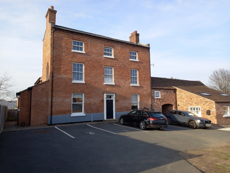
Public house. Early C19. Whitewashed brick with Welsh slate and plain tile roofs with coped gables and brick end stacks. L plan with 2-storey wing to rear. 3 storeys; 3-window range of 6/6 sashes under stucco lintels. 3/3 sashes above. On ground floor a later central porch has original doorcase within with door and overlight. 1/1 sashes either side. Lean-to on left end and outbuilding range on right end. This is of brick with plain tile roof and has, nearest to main range, an arched doorway with bulls-eye window to left and loft door above. INTERIOR: main range has room to right opened out but that to left survives mostly intact. This public house, on the side of the former Shrewsbury Canal, is marked on Wood's map of Shrewsbury of 1838.
Listing NGR: SJ4967013244
External links are from the relevant listing authority and, where applicable, Wikidata. Wikidata IDs may be related buildings as well as this specific building. If you want to add or update a link, you will need to do so by editing the Wikidata entry.


Other nearby listed buildings