Latitude: 52.7133 / 52°42'47"N
Longitude: -2.7453 / 2°44'43"W
OS Eastings: 349748
OS Northings: 313111
OS Grid: SJ497131
Mapcode National: GBR BJ.24TZ
Mapcode Global: WH8BT.S2X7
Plus Code: 9C4VP773+8V
Entry Name: 5-9, Severn Street
Listing Date: 28 August 1975
Last Amended: 17 November 1995
Grade: II
Source: Historic England
Source ID: 1254847
English Heritage Legacy ID: 458185
ID on this website: 101254847
Location: Castle Fields, Shropshire, SY1
County: Shropshire
Civil Parish: Shrewsbury
Built-Up Area: Shrewsbury
Traditional County: Shropshire
Lieutenancy Area (Ceremonial County): Shropshire
Church of England Parish: Shrewsbury All Saints and St Michael
Church of England Diocese: Lichfield
Tagged with: Building
SHREWSBURY
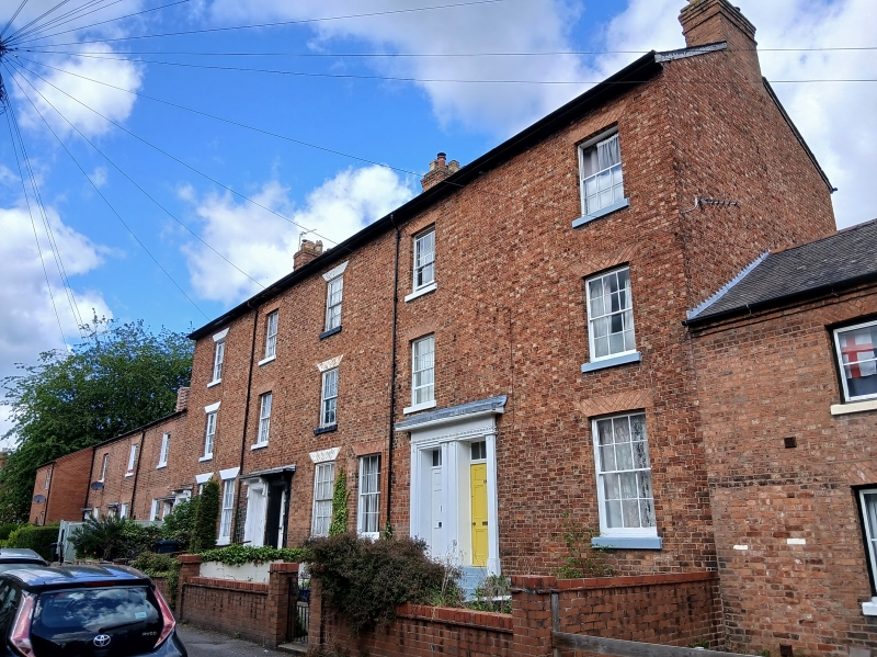
SJ41SE SEVERN STREET 653-1/4/608 (North East side) 28/08/75 Nos.5-9 (Consecutive) (Formerly Listed as: SEVERN STREET (North East side) Nos.1-17)
GV II
Row of 5 houses, formerly a weaving factory. Original structure c1806-1809, adapted and refronted c1860. Brick with Welsh slate roof, over iron-framed structure. 3 storeys, 5-window range. Single and paired doorways, the paired 6-panelled doors with overlights beneath single architraves. 12-pane sash windows on each floor, with wide splayed flat-arched heads, some painted. Plain oversailing eaves, axial stacks. Equal height of storeys, irregular window spacing, and traces of additional blocked openings between the windows on the upper floors are the external clues to the building's former use. INTERIOR: the cruciform cast-iron columns, beams and brick arched fire-proof ceilings of the iron-framed structure remain. Built as a weaving factory for Benyon and Bage's Canal Terminus flax mill.
Listing NGR: SJ4974813111
External links are from the relevant listing authority and, where applicable, Wikidata. Wikidata IDs may be related buildings as well as this specific building. If you want to add or update a link, you will need to do so by editing the Wikidata entry.


Other nearby listed buildings