Approximate Location Map
Large Map »
Latitude: 52.7055 / 52°42'19"N
Longitude: -2.7567 / 2°45'24"W
OS Eastings: 348967
OS Northings: 312251
OS Grid: SJ489122
Mapcode National: GBR BJ.2N07
Mapcode Global: WH8BT.M8H7
Plus Code: 9C4VP64V+68
Entry Name: 31 Town Walls and attached railings
Listing Date: 10 January 1953
Last Amended: 17 November 1995
Grade: II
Source: Historic England
Source ID: 1254932
English Heritage Legacy ID: 458379
Also known as: 29 Town Walls
ID on this website: 101254932
SJ 4812 SE
653-1/14/678
SHREWSBURY
TOWN WALLS (south side),
No. 31 and attached railings
(Formerly Listed as: TOWN WALLS (south side), No.31)
10/01/53
GV
II
Formerly known as: No. 29 TOWN WALLS.
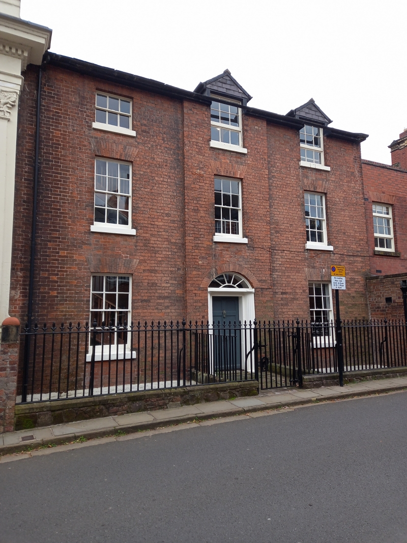
House. Late C18. Brick with Welsh slate roof. Three storeys over basement, three window range, the central bay advanced. Central six-panelled door with recessed Doric pilasters and shallow segmental fanlight over. Twelve-pane sash windows with flat-arched heads, nine-pane attic windows, raised as dormers in central and right-hand bays. Gable end stacks. Cast-iron railings to basement area with spearhead and urn finials.
Listing NGR: SJ4896712251
External links are from the relevant listing authority and, where applicable, Wikidata. Wikidata IDs may be related buildings as well as this specific building. If you want to add or update a link, you will need to do so by editing the Wikidata entry.


Other nearby listed buildings
