Approximate Location Map
Large Map »
Latitude: 52.7053 / 52°42'19"N
Longitude: -2.7561 / 2°45'22"W
OS Eastings: 349006
OS Northings: 312232
OS Grid: SJ490122
Mapcode National: GBR BJ.2N4P
Mapcode Global: WH8BT.M8RC
Plus Code: 9C4VP64V+4G
Entry Name: Watch Tower and Adjoining Wall
Listing Date: 10 January 1953
Last Amended: 17 November 1995
Grade: II*
Source: Historic England
Source ID: 1270530
English Heritage Legacy ID: 458386
ID on this website: 101270530
Location: Shrewsbury, Shropshire, SY1
County: Shropshire
Civil Parish: Shrewsbury
Built-Up Area: Shrewsbury
Traditional County: Shropshire
Lieutenancy Area (Ceremonial County): Shropshire
Church of England Parish: Shrewsbury St Chad
Church of England Diocese: Lichfield
Tagged with: Observation tower
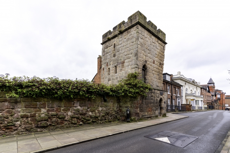
SHREWSBURY
SJ4912SW TOWN WALLS
653-1/15/685 (South side)
10/01/53 Watch Tower and adjoining wall
(Formerly Listed as:
TOWN WALLS
(South side)
Watch Tower)
GV II*
Watch tower. C13. Coursed and squared sandstone with flat
roof. 3-storeyed, square in plan with doorway in NE elevation
in slightly projecting lower storey, and a door at first-floor
level with moulded steeply-arched head. Arrow slits in SW
elevation, and small openings in NW. Renewed embattled
parapet. Length of Town Wall (qv) adjoins to left.
Listing NGR: SJ4900612232
External links are from the relevant listing authority and, where applicable, Wikidata. Wikidata IDs may be related buildings as well as this specific building. If you want to add or update a link, you will need to do so by editing the Wikidata entry.


Other nearby listed buildings
