Approximate Location Map
Large Map »
Latitude: 52.7054 / 52°42'19"N
Longitude: -2.7563 / 2°45'22"W
OS Eastings: 348994
OS Northings: 312235
OS Grid: SJ489122
Mapcode National: GBR BJ.2N3L
Mapcode Global: WH8BT.M8PB
Plus Code: 9C4VP64V+4F
Entry Name: 27 and 28, Town Walls
Listing Date: 10 January 1953
Last Amended: 17 November 1995
Grade: II
Source: Historic England
Source ID: 1255054
English Heritage Legacy ID: 458378
ID on this website: 101255054
Location: Kingsland, Shropshire, SY1
County: Shropshire
Civil Parish: Shrewsbury
Built-Up Area: Shrewsbury
Traditional County: Shropshire
Lieutenancy Area (Ceremonial County): Shropshire
Church of England Parish: Shrewsbury St Chad
Church of England Diocese: Lichfield
Tagged with: Building
SJ4812SE
653-1/14/677
10/01/53
SHREWSBURY
TOWN WALLS
(South side)
Nos.27 AND 28 and attached railings
(Formerly Listed as:
TOWN WALLS
(South side)
Nos.27 AND 28)
GV
II
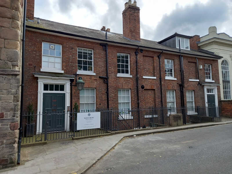
Pair of houses, now in commercial use. c1800. Brick with Welsh
slate roof. 2-storeyed with basements, each a 3-window range.
Outer 6-panelled doors in panelled architraves and paired
12-pane sash windows with flat-arched brick heads, and central
blind window space. Plain overhanging eaves. Coped gables, end
wall and axial stacks. Cast-iron railings to basement area
with urn and spearhead finials, and heavy cast-iron lantern
with leaded cap carried on long bracket projecting from wall
of No.27.
Listing NGR: SJ4899412235
External links are from the relevant listing authority and, where applicable, Wikidata. Wikidata IDs may be related buildings as well as this specific building. If you want to add or update a link, you will need to do so by editing the Wikidata entry.


Other nearby listed buildings
