Approximate Location Map
Large Map »
Latitude: 51.1495 / 51°8'58"N
Longitude: 0.6894 / 0°41'21"E
OS Eastings: 588194
OS Northings: 142359
OS Grid: TQ881423
Mapcode National: GBR QV4.T9J
Mapcode Global: VHJN2.WCTL
Plus Code: 9F324MXQ+RQ
Entry Name: Menny's Cottage
Listing Date: 12 March 1996
Grade: II
Source: Historic England
Source ID: 1255535
English Heritage Legacy ID: 459852
ID on this website: 101255535
Location: Smarden, Ashford, Kent, TN27
County: Kent
District: Ashford
Civil Parish: Smarden
Built-Up Area: Smarden
Traditional County: Kent
Lieutenancy Area (Ceremonial County): Kent
Tagged with: Cottage
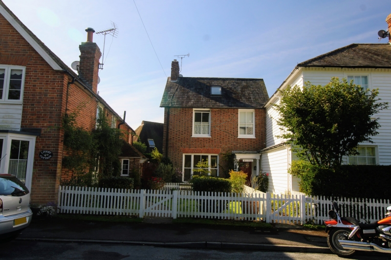
TQ 8842 SMARDEN THE STREET
29/10009 Menny's Cottage
GV II
Cottage. Circa 1860. Diaper brickwork and slate roof with left end chimneystack. Two storeys; 2 windows. Sashes with verticals only to first floor. Ground floor has triple sash with rubbed brick voussoirs. Right side Tuscan portico and 6 flush panelled door with top panels glazed.
Listing NGR: TQ8819342357
External links are from the relevant listing authority and, where applicable, Wikidata. Wikidata IDs may be related buildings as well as this specific building. If you want to add or update a link, you will need to do so by editing the Wikidata entry.


Other nearby listed buildings
