Latitude: 53.9153 / 53°54'54"N
Longitude: -2.1884 / 2°11'18"W
OS Eastings: 387720
OS Northings: 446583
OS Grid: SD877465
Mapcode National: GBR FR55.07
Mapcode Global: WHB7C.CV4C
Plus Code: 9C5VWR86+4J
Entry Name: 15 and 17, King Street
Listing Date: 5 July 1950
Grade: II
Source: Historic England
Source ID: 1258850
English Heritage Legacy ID: 186146
ID on this website: 101258850
Location: Barnoldswick, Pendle, Lancashire, BB18
County: Lancashire
District: Pendle
Civil Parish: Barnoldswick
Built-Up Area: Barnoldswick
Traditional County: Yorkshire
Lieutenancy Area (Ceremonial County): Lancashire
Tagged with: Building
SD 84 NE BARNOLDSWICK KING STREET
3/20 Nos 15 and 17
5.7.50
- II
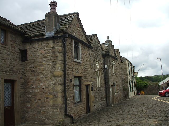
House, now in 2 occupations. Dated 1714, altered. Rubble, part rendered. Road front has 4 gables, two have springers and moulded copings. 4-light cross window between storeys, presumably to a staircase. Rear has a door with splayed reveals and cornice with panel over inscribed IEV/1714. Three windows per storey, one single-light and 2, 3-lights. One ground floor 3-light window is altered.
Listing NGR: SD8772046583
External links are from the relevant listing authority and, where applicable, Wikidata. Wikidata IDs may be related buildings as well as this specific building. If you want to add or update a link, you will need to do so by editing the Wikidata entry.


Other nearby listed buildings