Latitude: 53.392 / 53°23'31"N
Longitude: -3.1824 / 3°10'56"W
OS Eastings: 321462
OS Northings: 389004
OS Grid: SJ214890
Mapcode National: GBR 6Y66.TS
Mapcode Global: WH766.20TF
Plus Code: 9C5R9RR9+R2
Entry Name: Lighthouse and Adjoining Keepers House
Listing Date: 20 January 1988
Grade: II
Source: Historic England
Source ID: 1259767
English Heritage Legacy ID: 443657
Also known as: Hoylake upper lighthouse
ID on this website: 101259767
Location: Hoylake, Wirral, Merseyside, CH47
County: Wirral
Electoral Ward/Division: Hoylake and Meols
Parish: Non Civil Parish
Built-Up Area: Hoylake
Traditional County: Cheshire
Lieutenancy Area (Ceremonial County): Merseyside
Church of England Parish: Hoylake St Hildeburgh
Church of England Diocese: Chester
Tagged with: Lighthouse
SJ 28 NW HOYLAKE VALENTIA ROAD (north side) Hoylake
4/36 Lighthouse and adjoining - Keepers house
- II
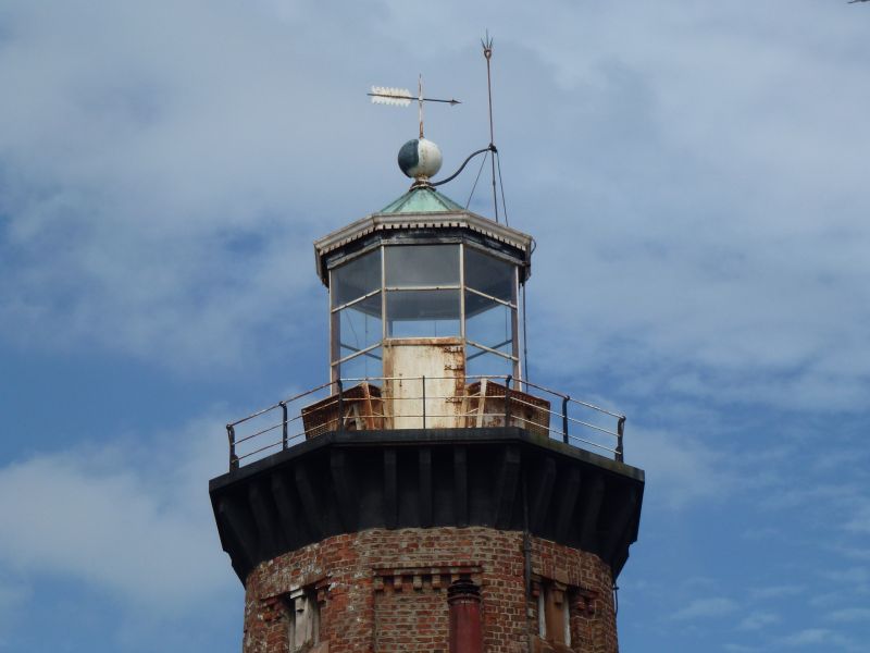
Lighthouse, now disused, and keeper's house. 1865. Brick with stone dressings. Octagonal. Battered base of rock faced stone with entrance to north and windows to east and west; roll-moulded cap. Tower has pilaster strips to angles, the bases of stone; the sides have corbelling to top. Small lights to stair and upper chamber on alternate sides. Stone platform on deep stone brackets has iron rail and top octagonal glazed light chamber, conical roof and weather vane. Interior has cast iron flying spiral stair with mahogany hand rail. Adjoining keeper's house of brick, 2 storeys with central porch and flanking 2-storey canted bay windows; one-storey end blocks. Windows are segmental headed, with casements.
Listing NGR: SJ2146289004
External links are from the relevant listing authority and, where applicable, Wikidata. Wikidata IDs may be related buildings as well as this specific building. If you want to add or update a link, you will need to do so by editing the Wikidata entry.


Other nearby listed buildings