Approximate Location Map
Large Map »
Latitude: 51.1954 / 51°11'43"N
Longitude: 1.3495 / 1°20'58"E
OS Eastings: 634120
OS Northings: 149350
OS Grid: TR341493
Mapcode National: GBR X22.S16
Mapcode Global: VHLH5.B6SZ
Plus Code: 9F3358WX+4R
Entry Name: Barn at Wingleton Farm (TR 3412 4935)
Listing Date: 24 March 1987
Grade: II
Source: Historic England
Source ID: 1264297
English Heritage Legacy ID: 428202
ID on this website: 101264297
Location: Sutton, Dover, Kent, CT15
County: Kent
District: Dover
Civil Parish: Sutton
Traditional County: Kent
Lieutenancy Area (Ceremonial County): Kent
Tagged with: Barn
SUTTON
TR 34 NW
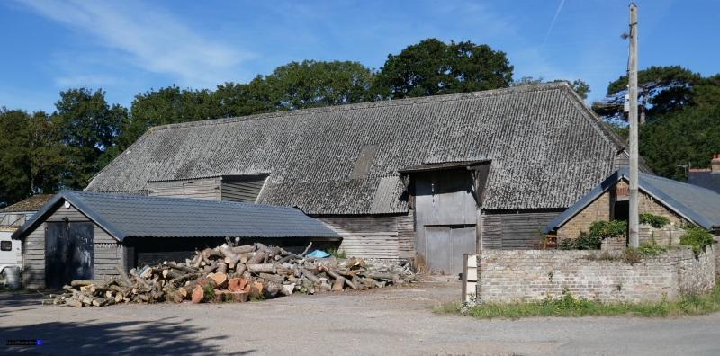
7/87 Barn at Wingleton
Farm (TR 3412 4935)
II
Barn. Early C18. Timber framed on painted brick and flint base, and clad
with weather boarding with corrugated asbestos roofing. Half-hipped roof
with 2 raking midstreys. Interior: 7 bays with aisles, with quadrant
bracing.
Listing NGR: TR3412049350
External links are from the relevant listing authority and, where applicable, Wikidata. Wikidata IDs may be related buildings as well as this specific building. If you want to add or update a link, you will need to do so by editing the Wikidata entry.


Other nearby listed buildings
