Latitude: 51.5109 / 51°30'39"N
Longitude: -0.1401 / 0°8'24"W
OS Eastings: 529163
OS Northings: 180748
OS Grid: TQ291807
Mapcode National: GBR DD.QK
Mapcode Global: VHGQZ.J982
Plus Code: 9C3XGV65+9X
Entry Name: 11, Savile Row W1
Listing Date: 1 December 1987
Grade: II*
Source: Historic England
Source ID: 1264751
English Heritage Legacy ID: 427027
ID on this website: 101264751
Location: St James's, Westminster, London, W1S
County: London
District: City of Westminster
Electoral Ward/Division: West End
Parish: Non Civil Parish
Built-Up Area: City of Westminster
Traditional County: Middlesex
Lieutenancy Area (Ceremonial County): Greater London
Church of England Parish: St James Piccadilly
Church of England Diocese: London
Tagged with: Building
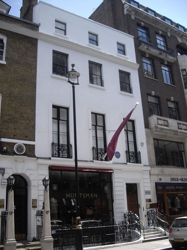
TQ 2980 NW CITY OF WESTMINSTER SAVILE ROW Wl 70/105 No 11 GV II Terrace house. c. 1733 altered. Stuccoed,slate roof. 3 storeys, basement and dormered mansard. 3 windows wide. Ground floor has mid C20 shop front, doorway to right. Recessed sashes, no glazing bars to upper floors, in architrave surrounds. Entablature over 2nd floor and parapet with coping. Cast iron grilles to 1st floor windows. Cast iron area railings. Interior has only a few fragments of cornices and plasterwork, staircase altered. Part of Burlington Estate. Included for group value only. Survey of London; vol XXXII
Listing NGR: TQ2916380747
External links are from the relevant listing authority and, where applicable, Wikidata. Wikidata IDs may be related buildings as well as this specific building. If you want to add or update a link, you will need to do so by editing the Wikidata entry.


Other nearby listed buildings