Latitude: 51.5841 / 51°35'2"N
Longitude: -2.0966 / 2°5'47"W
OS Eastings: 393402
OS Northings: 187255
OS Grid: ST934872
Mapcode National: GBR 2QZ.QQ7
Mapcode Global: VH95S.LFZZ
Plus Code: 9C3VHWM3+J9
Entry Name: Moravian Church and Attached Side Area Railings and Pier
Listing Date: 1 July 1976
Grade: II
Source: Historic England
Source ID: 1269305
English Heritage Legacy ID: 460927
ID on this website: 101269305
Location: Malmesbury, Wiltshire, SN16
County: Wiltshire
Civil Parish: Malmesbury
Built-Up Area: Malmesbury
Traditional County: Wiltshire
Lieutenancy Area (Ceremonial County): Wiltshire
Church of England Parish: Malmesbury and Brokenborough
Church of England Diocese: Bristol
Tagged with: Architectural structure
MALMESBURY
ST9387 OXFORD STREET 758-1/4/269 Moravian Church and attached side 01/07/76 area railings and pier
GV II
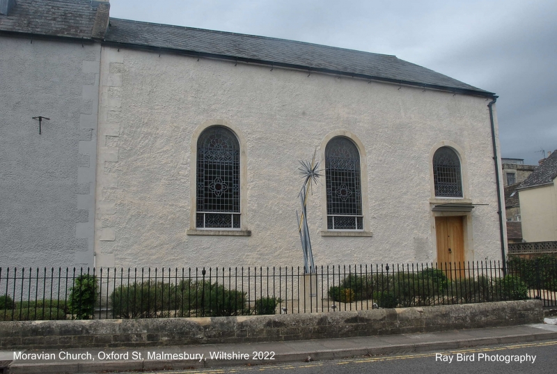
Moravian church. 1770. Roughcast limestone rubble, limestone dressings and slate roof. Open plan. Single storey; 3-window range. 3 round-arched windows with late C19 stained glass, the right-hand one including a doorway with a ridge door and moulded timber canopy; windowless end gable. INTERIOR: details include a good panelled octagonal pulpit with ogee hour-glass base and steps with column-on-vase balusters and ramped rail, gallery to the rear on 2 cast-iron posts, and panelled wainscot; organ. SUBSIDIARY FEATURES: attached spear-headed iron railings and dwarf walls, gates, enclosing area in front with a right-hand ashlar pier. Further information: The Church is attached to the Manse (qv). (Victoria History of the Counties of England: Crowley DA: Wiltshire: 1991-: 159).
Listing NGR: ST9339687259
External links are from the relevant listing authority and, where applicable, Wikidata. Wikidata IDs may be related buildings as well as this specific building. If you want to add or update a link, you will need to do so by editing the Wikidata entry.


Other nearby listed buildings