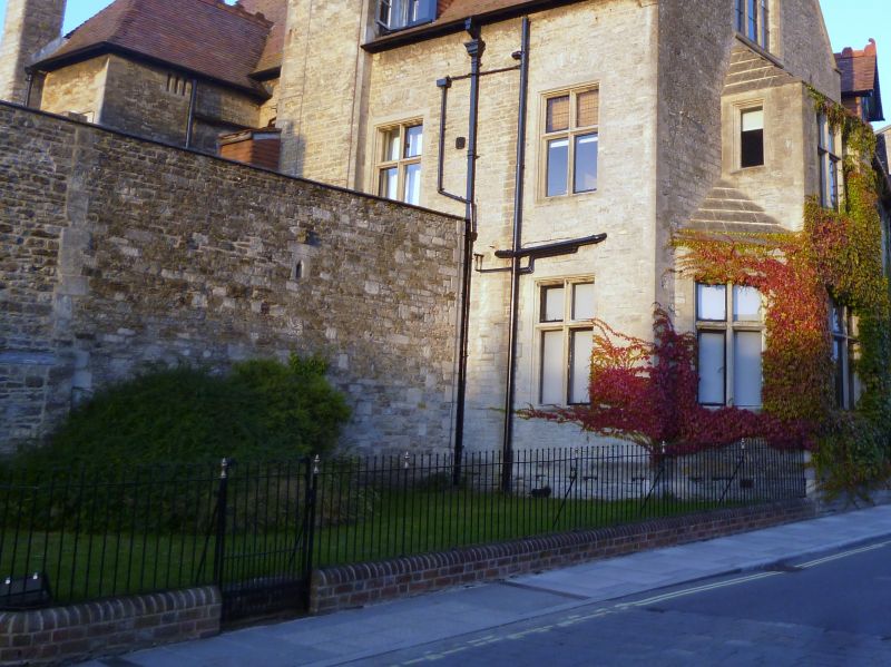
Latitude: 51.5849 / 51°35'5"N
Longitude: -2.0996 / 2°5'58"W
OS Eastings: 393198
OS Northings: 187341
OS Grid: ST931873
Mapcode National: GBR 2QZ.Q00
Mapcode Global: VH95S.KFDC
Plus Code: 9C3VHWM2+X5
Entry Name: Wall Attached to West Corner of the Old Bell Hotel
Listing Date: 1 July 1976
Last Amended: 19 July 1996
Grade: II
Source: Historic England
Source ID: 1269522
English Heritage Legacy ID: 460675
ID on this website: 101269522
Location: Malmesbury, Wiltshire, SN16
County: Wiltshire
Civil Parish: Malmesbury
Built-Up Area: Malmesbury
Traditional County: Wiltshire
Lieutenancy Area (Ceremonial County): Wiltshire
Church of England Parish: Malmesbury and Brokenborough
Church of England Diocese: Bristol
Tagged with: Wall
MALMESBURY
ST9387 ABBEY ROW 758-1/4/14 (North side) 01/07/76 Wall attached to west corner of the Old Bell Hotel (Formerly Listed as: Boundary wall north-west of The Old Bell)
GV II
Wall. C18/19. Limestone rubble. Wall in 2 sections extending approx 10m, the right-hand section has quoins and a small re-used stoop, the left-hand section incorporates 3 re-used medieval fragments and timber lintels to blocked openings. HISTORICAL NOTE: the castle built by Roger of Salisbury c1118-39 was probably to one side or the other of Mill Lane, and reportedly encroached on a graveyard 'a stone's throw from the abbey church'. After the acquisition of the castle in 1216 by the abbey, the outer court was extended, and it is possible that the gateway of the outer court was at the junction of Abbey Row and Mill Lane. (Keystone Historic Building Consultants: The Town Walls of Malmesbury: 1994-: 18-19).
Listing NGR: ST9319987339
External links are from the relevant listing authority and, where applicable, Wikidata. Wikidata IDs may be related buildings as well as this specific building. If you want to add or update a link, you will need to do so by editing the Wikidata entry.


Other nearby listed buildings