Latitude: 50.1468 / 50°8'48"N
Longitude: -5.0643 / 5°3'51"W
OS Eastings: 181171
OS Northings: 31915
OS Grid: SW811319
Mapcode National: GBR ZD.TYQG
Mapcode Global: FRA 088M.QVP
Plus Code: 9C2P4WWP+P7
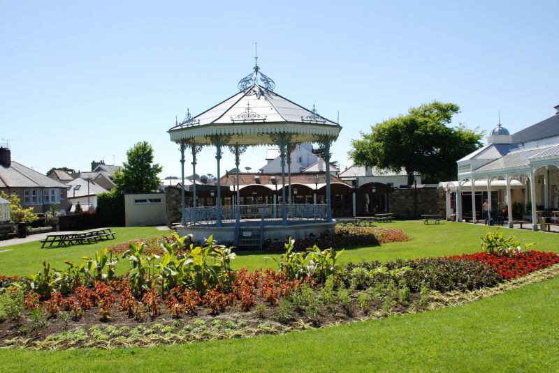
Entry Name: The Bandstand, Gyllyngdune Gardens
Listing Date: 24 April 1996
Grade: II
Source: Historic England
Source ID: 1270087
English Heritage Legacy ID: 460124
ID on this website: 101270087
Location: Gyllyngdune Gardens, Cornwall, TR11
County: Cornwall
Civil Parish: Falmouth
Built-Up Area: Falmouth
Traditional County: Cornwall
Lieutenancy Area (Ceremonial County): Cornwall
Church of England Parish: Falmouth King Charles the Martyr
Church of England Diocese: Truro
Tagged with: Architectural structure
FALMOUTH
SW83SW CLIFF ROAD 843-1/2/77 (North side) The Bandstand, Gyllyngdune Gardens
GV II
Bandstand. 1907, by WH Tresidder. Cast iron on moulded rendered base; zinc roof with multi-pendanted eaves, scrolled crest over each bay and central finial with scroll and leaf decoration. Octagonal plan. Arcade of shaped arches with ornate spandrels on slender columns; balustrades with straight and twist balusters and elaborate panels. HISTORY: built for the Corporation of Falmouth who bought a portion of the Gyllyngdune estate and is the most notable part of a pleasure garden complex with the Princess Pavilion. (Working Party of District Councillors: The Princess Pavilion and Gyllyngdune Gardens (Future Plan): 1992-).
Listing NGR: SW8117131915
External links are from the relevant listing authority and, where applicable, Wikidata. Wikidata IDs may be related buildings as well as this specific building. If you want to add or update a link, you will need to do so by editing the Wikidata entry.


Other nearby listed buildings