Approximate Location Map
Large Map »
Latitude: 51.2798 / 51°16'47"N
Longitude: 0.127 / 0°7'37"E
OS Eastings: 548442
OS Northings: 155549
OS Grid: TQ484555
Mapcode National: GBR LLJ.NY6
Mapcode Global: VHHPR.43Z8
Plus Code: 9F3274HG+WQ
Entry Name: Wall Around Courtyard to West of Little Combe Bank
Listing Date: 16 January 1975
Last Amended: 20 September 1976
Grade: II
Source: Historic England
Source ID: 1272639
English Heritage Legacy ID: 448433
ID on this website: 101272639
Location: Sundridge, Sevenoaks, Kent, TN14
County: Kent
District: Sevenoaks
Civil Parish: Sundridge with Ide Hill
Built-Up Area: Sundridge
Traditional County: Kent
Lieutenancy Area (Ceremonial County): Kent
Church of England Parish: Sundridge St Mary
Church of England Diocese: Rochester
Tagged with: Wall
1.
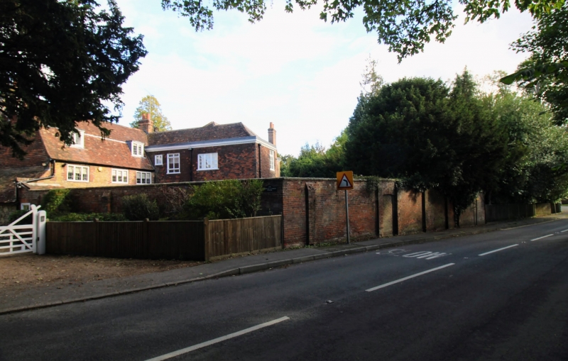
5280 SUNDRIDGE SUNDRIDGE
Combe Bank Road
(East Side)
Wall around courtyard to
West of Little Combe Bank
TQ 4855 32/1263
II
2.
C18 high red brick wall with random rubble plinth and sloped buttresses.
Listing NGR: TQ4844555546
External links are from the relevant listing authority and, where applicable, Wikidata. Wikidata IDs may be related buildings as well as this specific building. If you want to add or update a link, you will need to do so by editing the Wikidata entry.


Other nearby listed buildings
