Latitude: 51.1531 / 51°9'10"N
Longitude: 0.3768 / 0°22'36"E
OS Eastings: 566318
OS Northings: 141996
OS Grid: TQ663419
Mapcode National: GBR NR2.L2J
Mapcode Global: VHJMX.H81X
Plus Code: 9F32593G+6P
Entry Name: Whitethorn Cottages
Listing Date: 24 August 1990
Grade: II
Source: Historic England
Source ID: 1277614
English Heritage Legacy ID: 430926
ID on this website: 101277614
Location: Matfield, Tunbridge Wells, Kent, TN12
County: Kent
District: Tunbridge Wells
Civil Parish: Brenchley
Built-Up Area: Brenchley
Traditional County: Kent
Lieutenancy Area (Ceremonial County): Kent
Church of England Parish: Brenchley All Saints
Church of England Diocese: Rochester
Tagged with: Cottage
TQ 64 SE BRENCHLEY BRENCHLEY ROAD, HOMEBUSH
6/44 Nos 5 and 6 Whitethorn Cottages
GV II
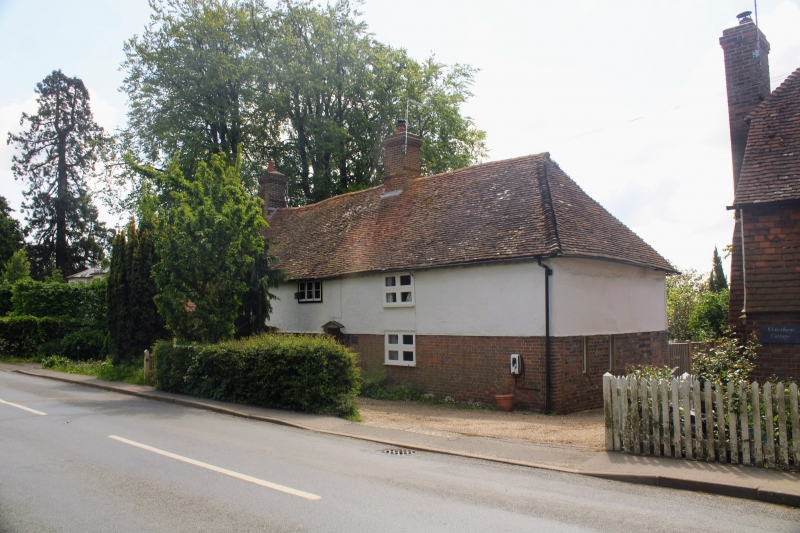
Pair of houses, possibly originally one house. Circa late C17 or earlier. Ground floor Flemish bond brick, first floor rendered over framed construction, which is said to survive on the ground floor (information from the owner); peg-tile roof; brick stacks.
Plan: Details of plan unclear on survey as interior not inspected (1989). The range faces approximately north, fronting the road. 4-rooms wide, the 2 centre rooms probably heated by back-to-back fireplaces in an axial stack, the left hand room heated by an end stack. No 6, to the left, double fronted, No 5 with a front door to the left, apparently into a lobby entrance against the axial stack.
Exterior: 2 storeys. Roof gabled at left end, hipped at right end. Asymmetrical 2:1 window front. C19 or C20 plank front doors with shallow gabled porch hoods on brackets. No 6, to the left, has 2 first and 2 ground floor late Cl9 or C20 casements, 2 panes per light. First floor window left extends across a stud or wall post. No 5 has one first and one ground floor plate glass 2-light casements.
Interior: Not inspected but No 6 has exposed carpentry (information from the owner) and an open fireplace with a replaced lintel.
The range is said to be dated 1623 (information from the owner) and an internal and roof inspection might necessitate revising the dating suggested here.
Listing NGR: TQ6631841996
External links are from the relevant listing authority and, where applicable, Wikidata. Wikidata IDs may be related buildings as well as this specific building. If you want to add or update a link, you will need to do so by editing the Wikidata entry.


Other nearby listed buildings