Latitude: 52.3885 / 52°23'18"N
Longitude: 1.0135 / 1°0'48"E
OS Eastings: 605158
OS Northings: 280996
OS Grid: TM051809
Mapcode National: GBR SG9.C19
Mapcode Global: VHKCQ.J749
Plus Code: 9F4392Q7+C9
Entry Name: Granary Immediately North West of Oxfootstone Farmhouse
Listing Date: 8 November 1988
Grade: II
Source: Historic England
Source ID: 1277959
English Heritage Legacy ID: 220642
ID on this website: 101277959
Location: Low Common, Breckland, Norfolk, IP22
County: Norfolk
District: Breckland
Civil Parish: South Lopham
Traditional County: Norfolk
Lieutenancy Area (Ceremonial County): Norfolk
Church of England Parish: South Lopham
Church of England Diocese: Norwich
Tagged with: Granary
TM 08 SE SOUTH LOPHAM BRICK KILN LANE
7/110 Granary immediately north west of Oxfootstone Farmhouse
GV II
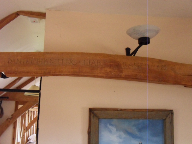
Disused granary. "DANIEL HAMLING March 3 Raised 1822" carved on a roof tie. Rectangular in plan. Single storey additions to west and south. Rendered and tarred timber frame with wattle and daub infill on tall brick and flint plinth. Weatherboarded gable-ends and pantile roof. East facade with 4 2-light ventilation openings, one boarded door and a 2-leaf bearded cart door. West facade with one 2-light ventilation opening and a boarded door. Interior. 2 low rooms to ground floor and cart-entrance bay open to roof. Plaster ceiling between floor joists. Modern staircase leading to grain floor. Timber frame of light scantling with tension bracing, jowled principal posts with 5 arch-braced ties. Separate principal rafter trusses with upper and lower collars. Wedgetenoned butt purlins. Rafters complete and resting on the backs of the purlins and with a ridge board at the apex.
Listing NGR: TM0515880996
External links are from the relevant listing authority and, where applicable, Wikidata. Wikidata IDs may be related buildings as well as this specific building. If you want to add or update a link, you will need to do so by editing the Wikidata entry.


Other nearby listed buildings