Latitude: 51.2091 / 51°12'32"N
Longitude: -3.48 / 3°28'48"W
OS Eastings: 296709
OS Northings: 146585
OS Grid: SS967465
Mapcode National: GBR LJ.4260
Mapcode Global: VH5JY.MVLZ
Plus Code: 9C3R6G59+JX
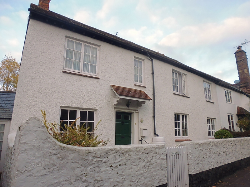
Entry Name: Fern Cottage (Number 7) and Attached Front Garden Wall
Listing Date: 4 July 1952
Last Amended: 30 September 1994
Grade: II
Source: Historic England
Source ID: 1279954
English Heritage Legacy ID: 391159
ID on this website: 101279954
Location: Higher Town, Somerset, TA24
County: Somerset
District: Somerset West and Taunton
Civil Parish: Minehead
Built-Up Area: Minehead
Traditional County: Somerset
Lieutenancy Area (Ceremonial County): Somerset
Tagged with: Cottage
MINEHEAD
SS9646 CHURCH STREET 900-1/3/25 (West side) 04/07/52 Nos.7 AND 9 Fern Cottage (No.7) and attached front garden walls (Formerly Listed as: CHURCH STREET, Minehead (West side) Nos.7 AND 9)
GV II
2 houses. C18 No.7 and C17 or earlier No.9, heightened and altered C19. Painted C20 roughcast over rubblestone. No.7, to the left, has exposed rafter ends to plain tile roof with brick stacks to the front left of the ridge and to the rear. 3-unit plan with rear additions; through-passage to left of front lateral stack with hall bay adjoining to right. 2 storeys; 4-window range. C20 two-light casement windows. The C18 door to the left of centre has 6 raised and fielded panels under shaped C18 brackets supporting a C20 lean-to tiled porch. No.9 has exposed rafter ends to a C19 crested slate roof with lateral stack to centre front and rear left. 2-unit plan with rear additions. 2 storeys; 3-window range. C19 two- and three-light casement windows, those to the ground floor under segmental arches. The projecting lateral stack has a fire window to the left return, an inserted window to each floor to the right, and similar to the far right. To the left of the stack is a C19 six-panelled door glazed to the top with C19 brackets to a lean-to porch. INTERIORS not inspected. SUBSIDIARY FEATURES: the small front gardens are enclosed with painted rubblestone walls approx 1m high which sweep up to meet the houses.
Listing NGR: SS9670946585
External links are from the relevant listing authority and, where applicable, Wikidata. Wikidata IDs may be related buildings as well as this specific building. If you want to add or update a link, you will need to do so by editing the Wikidata entry.


Other nearby listed buildings