Latitude: 53.7995 / 53°47'58"N
Longitude: -2.377 / 2°22'37"W
OS Eastings: 375268
OS Northings: 433755
OS Grid: SD752337
Mapcode National: GBR CSVH.6Q
Mapcode Global: WH96Q.GRBL
Plus Code: 9C5VQJXF+R6
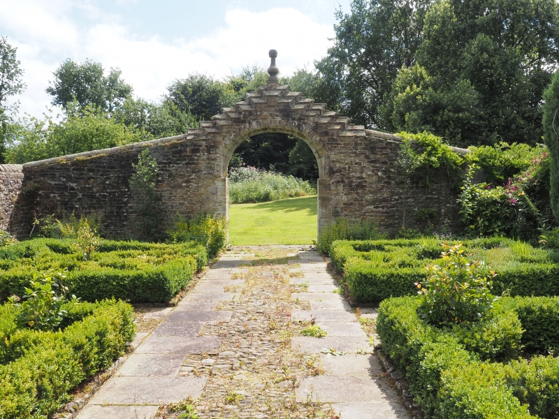
Entry Name: Outer Archway at Martholme
Listing Date: 11 July 1966
Grade: II*
Source: Historic England
Source ID: 1280458
English Heritage Legacy ID: 183877
ID on this website: 101280458
Location: Hyndburn, Lancashire, BB6
County: Lancashire
District: Hyndburn
Electoral Ward/Division: Netherton
Parish: Non Civil Parish
Built-Up Area: Great Harwood
Traditional County: Lancashire
Lieutenancy Area (Ceremonial County): Lancashire
Church of England Parish: Great Harwood St Bartholomew and St John
Church of England Diocese: Blackburn
Tagged with: Archway
GREAT HARWOOD MARTHOLME LANE SD 73 SE 3/74 Outer Archway at Martholme 11.7.1966 GV II*
Gate arch in centre of sloped wall, dated 1607. Random rubble with dressings. Moulded semi-circular-headed arch with vigorously crow-stepped coping surmounted by a finial. Above apex of arch on south side is carved stone with shield, lettered at the sides "R" "H" (for Robert Hesketh) and in the bottom corners "16" "07".
Listing NGR: SD7526833755
External links are from the relevant listing authority and, where applicable, Wikidata. Wikidata IDs may be related buildings as well as this specific building. If you want to add or update a link, you will need to do so by editing the Wikidata entry.


Other nearby listed buildings