Latitude: 50.5595 / 50°33'34"N
Longitude: -2.4465 / 2°26'47"W
OS Eastings: 368470
OS Northings: 73401
OS Grid: SY684734
Mapcode National: GBR PY.HZ93
Mapcode Global: FRA 57RL.BQC
Plus Code: 9C2VHH53+RC
Entry Name: 165, High Street
Listing Date: 23 July 1975
Grade: II
Source: Historic England
Source ID: 1280550
English Heritage Legacy ID: 381974
ID on this website: 101280550
Location: Chiswell, Dorset, DT5
County: Dorset
Civil Parish: Portland
Built-Up Area: Fortuneswell
Traditional County: Dorset
Lieutenancy Area (Ceremonial County): Dorset
Church of England Parish: Portland All Saints
Church of England Diocese: Salisbury
Tagged with: Building
PORTLAND
SY6873 HIGH STREET, Fortuneswell 969-1/3/114 (South side) 23/07/75 No.165
GV II
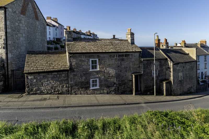
House at lower end of short row. Early C19, some parts possibly earlier. Large squared coursed block, slate or concrete slate roofs and stone end stacks. In two stepped sections: the highest, adjoining No 163 (qv) on left, is a small C20 one-storey gabled store; then a two- storey unit, slightly canted following street line, has 4-pane sash at each level to left end, and, right, a C19 raised fielded panel door, two panels glazed, in stone-cheeked porch with flat concrete slab; these two parts with concrete slate roofs. The building, which adjoins No 120 Chiswell (qv), steps down the steep incline at this point in High Street, and the return frontage faces down into Chiswell, holding an important position in the townscape.
Listing NGR: SY6847073401
External links are from the relevant listing authority and, where applicable, Wikidata. Wikidata IDs may be related buildings as well as this specific building. If you want to add or update a link, you will need to do so by editing the Wikidata entry.


Other nearby listed buildings