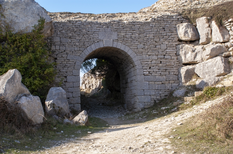
Latitude: 50.5535 / 50°33'12"N
Longitude: -2.4459 / 2°26'45"W
OS Eastings: 368509
OS Northings: 72730
OS Grid: SY685727
Mapcode National: GBR PY.J5LM
Mapcode Global: FRA 57RL.QYF
Plus Code: 9C2VHH33+9M
Entry Name: Bridge in Touts Quarry at Ngr Sy 685 727
Listing Date: 17 May 1993
Grade: II
Source: Historic England
Source ID: 1281839
English Heritage Legacy ID: 382082
ID on this website: 101281839
Location: Fortuneswell, Dorset, DT5
County: Dorset
Civil Parish: Portland
Traditional County: Dorset
Lieutenancy Area (Ceremonial County): Dorset
Church of England Parish: Portland All Saints
Church of England Diocese: Salisbury
Tagged with: Bridge
PORTLAND
SY67SE WIDE STREET, Yeates 969-1/1/191 (West side (off)) Bridge in Touts Quarry at NGR SY 685 727
II
Foot bridge over track or quarry rail bed. Dated 1854. Dry-laid thin-bedded Portland stone with ashlar dressings. Set between natural rock revetments where track cut through, arch c 2.5m wide and 3.5m to crown, to tunnel vault c4m long, in good dressed quoins and voussoirs, including cranked single stone voussoir at haunches; above crown a plain stone with inscription 'J.C.LANO 1854'. Bridge rises to c 5.5m, without parapets, and with overgrown earth walkway. On the NW side, which is overgrown with ivy (June 1991), there is an adit on the N side, blocked with loose masonry at c 3m depth. A flight of 27 concrete steps descends by the S abutment. The name Lano occurs amongst the inscriptions in the churchyard to St. George Reforne; this is a well-built structure with some design pretension in an abandoned quarry area.
Listing NGR: SY6850972730
External links are from the relevant listing authority and, where applicable, Wikidata. Wikidata IDs may be related buildings as well as this specific building. If you want to add or update a link, you will need to do so by editing the Wikidata entry.


Other nearby listed buildings