Latitude: 52.5959 / 52°35'45"N
Longitude: -2.1728 / 2°10'22"W
OS Eastings: 388389
OS Northings: 299799
OS Grid: SO883997
Mapcode National: GBR 12F.JV
Mapcode Global: WHBFY.L0JR
Plus Code: 9C4VHRWG+8V
Entry Name: The Grange
Listing Date: 3 February 1987
Grade: II
Source: Historic England
Source ID: 1282503
English Heritage Legacy ID: 378424
ID on this website: 101282503
Location: Tettenhall, Wolverhampton, West Midlands, WV6
County: City of Wolverhampton
Electoral Ward/Division: Tettenhall Regis
Parish: Non Civil Parish
Built-Up Area: Wolverhampton
Traditional County: Staffordshire
Lieutenancy Area (Ceremonial County): West Midlands
Church of England Parish: Tettenhall Regis
Church of England Diocese: Lichfield
Tagged with: Building
WOLVERHAMPTON
SJ89NE GRANGE ROAD, Tettenhall 895-1/4/124 (East side) 03/02/87 The Grange
II
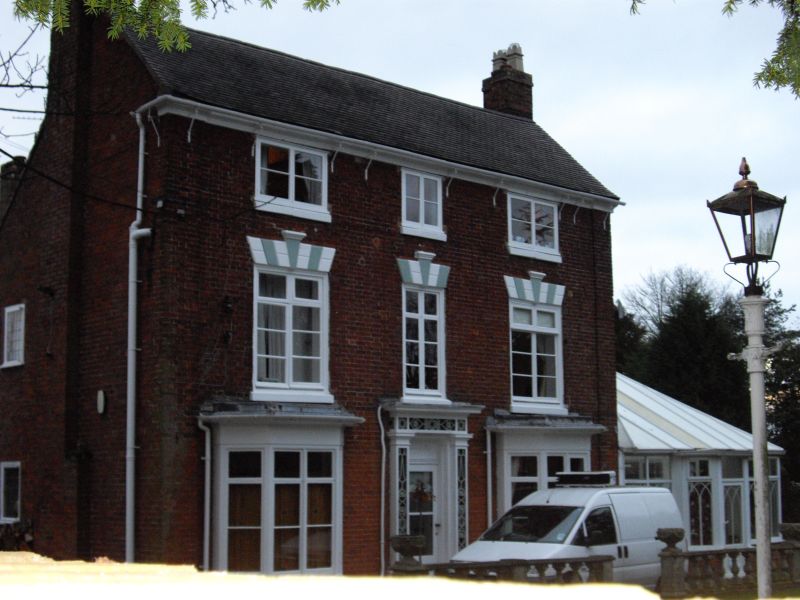
Farmhouse, now house. Probably C17, altered and extended in late C18-early C19; later alterations in later C19. Timber-framed core to house now mostly clad in red brick externally; plain tiled roofs; tall projecting red brick end stacks with oversailing cornices. 3 storeys; symmetrical 3-window front. Central windows narrower; canted bay windows to ground floor, these probably late C19 additions; 1st floor has rusticated wedge lintels to windows with fluted keys over casements; 2nd floor has smaller windows with shallow casements. Entrance has mid C19 doorcase with open strapwork ornament and paired glazed doors. Gabled wings to rear; some casemented windows with leaded glazing. INTERIOR: Much evidence of timber-framed core, including studding, wall posts and beams. Late C18 fireplace, possibly brought in to one ground floor room; late C19 range with cupboards in kitchen extension; a number of C18 panelled and boarded doors; early C18 stair with closed string, moulded handrail, slightly bulbous turned balusters with square knops and columnar foot newel.
Listing NGR: SO8838999799
External links are from the relevant listing authority and, where applicable, Wikidata. Wikidata IDs may be related buildings as well as this specific building. If you want to add or update a link, you will need to do so by editing the Wikidata entry.


Other nearby listed buildings