Latitude: 53.5359 / 53°32'9"N
Longitude: -2.0887 / 2°5'19"W
OS Eastings: 394216
OS Northings: 404367
OS Grid: SD942043
Mapcode National: GBR FWVK.L6
Mapcode Global: WHB9B.WDK4
Plus Code: 9C5VGWP6+9G
Entry Name: Church of St Mathew and St Aidan
Listing Date: 9 March 1982
Grade: II
Source: Historic England
Source ID: 1282553
English Heritage Legacy ID: 388932
ID on this website: 101282553
Location: Salvation Army Hall, New Earth, Oldham, Greater Manchester, OL4
County: Oldham
Electoral Ward/Division: St Mary's
Parish: Non Civil Parish
Built-Up Area: Oldham
Traditional County: Lancashire
Lieutenancy Area (Ceremonial County): Greater Manchester
Church of England Parish: Leesfield St Thomas
Church of England Diocese: Manchester
Tagged with: Church building
OLDHAM
SD90SW ROUNDTHORN ROAD 780-1/3/68 (North East side) 09/03/82 Church of St Mathew and St Aidan
II
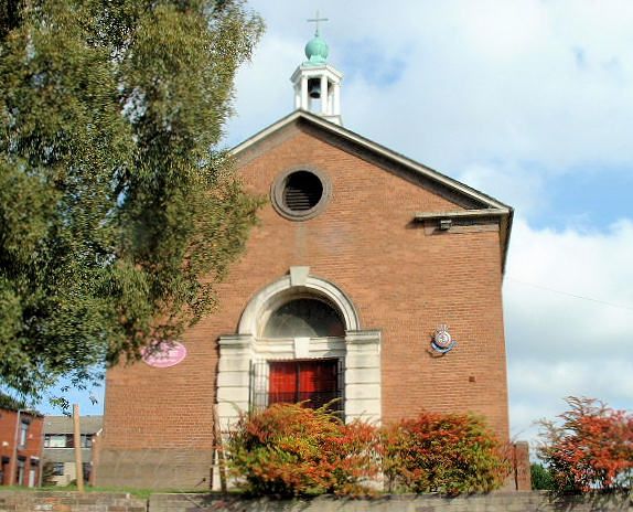
Parish church. 1933. By Taylor and Young. Brick with stone dressings and Welsh slate roof. Severe neo-classical style. Single span with west doorway. Pedimented western gable, and cupola housing bell above, with Tuscan shafts carrying lantern roof. Rusticated architrave to entrance, with panelled doors with fanlight and oculus over. 5 round-arched leaded lights with stone keys and brick panelled aprons to north and south, and oculi to east and west of side walls, and eastern doorways. Chancel and flanking vestries possibly slightly later additions. Flat-roofed chancel with single round-arched window with recessed panel over string course in north and south walls. Eastern doorway in projecting pedimented architrave.
Listing NGR: SD9421604367
External links are from the relevant listing authority and, where applicable, Wikidata. Wikidata IDs may be related buildings as well as this specific building. If you want to add or update a link, you will need to do so by editing the Wikidata entry.


Other nearby listed buildings