Latitude: 52.3249 / 52°19'29"N
Longitude: -2.1987 / 2°11'55"W
OS Eastings: 386556
OS Northings: 269659
OS Grid: SO865696
Mapcode National: GBR 1DM.8XN
Mapcode Global: VH921.VT0M
Plus Code: 9C4V8RF2+WG
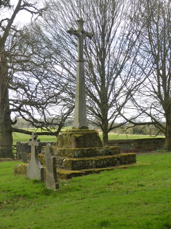
Entry Name: Churchyard Cross About 10 Metres South of Nave of Church of St Michael
Listing Date: 14 March 1969
Grade: II
Source: Historic England
Source ID: 1288205
English Heritage Legacy ID: 400333
ID on this website: 101288205
Location: St Michael's Church, Elmley Lovett, Wychavon, Worcestershire, WR9
County: Worcestershire
District: Wychavon
Civil Parish: Elmley Lovett
Traditional County: Worcestershire
Lieutenancy Area (Ceremonial County): Worcestershire
Church of England Parish: Elmley Lovett
Church of England Diocese: Worcester
ELMLEY LOVETT CP ELMLEY LOVETT SO 86 NE Churchyard cross 5/44 about 10 metres south of nave of Church of 14.3.69 St Michael
II GV
Churchyard cross. C15 restored late C19. Ashlar. Three steps square in plan, square plinth block with octagonal top into which is mounted a broken off tapered octagonal shaft; the C19 restored shaft and cross head have recently broken off and lie beside the medieval part.
Listing NGR: SO8655669659


Other nearby listed buildings