Latitude: 53.501 / 53°30'3"N
Longitude: -2.3814 / 2°22'53"W
OS Eastings: 374797
OS Northings: 400550
OS Grid: SD747005
Mapcode National: GBR CWTY.7P
Mapcode Global: WH988.D87C
Plus Code: 9C5VGJ29+CC
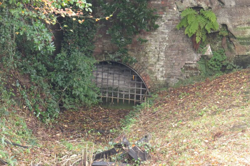
Entry Name: Western Tunnel Entrance to Underground Canal
Listing Date: 29 July 1966
Last Amended: 2 September 1987
Grade: II
Source: Historic England
Source ID: 1288256
English Heritage Legacy ID: 400037
ID on this website: 101288256
Location: Worsley, Salford, Greater Manchester, M28
County: Salford
Electoral Ward/Division: Worsley
Parish: Non Civil Parish
Traditional County: Lancashire
Lieutenancy Area (Ceremonial County): Greater Manchester
Church of England Parish: Worsley St Mark
Church of England Diocese: Manchester
Tagged with: Architectural structure
WORSLEY THE DELPH SD 70 SW 1/52 Western tunnel entrance to under- ground canal (formerly listed as pair of entrances to former mine 29/7/66 canal-tunnels) G.V. II
Tunnel-entrance. c.1760. By James Brindley. Segmental-arched brick lining to the entrance which is hewn out of the rock face. The beginning of approx. 46 miles of underground canal which was used to extract coal up to the late C19. The entrance opens into the Delph and is connected directly to the Duke of Bridgewater's canal network. Scheduled ancient monument.
Listing NGR: SD7479700549
External links are from the relevant listing authority and, where applicable, Wikidata. Wikidata IDs may be related buildings as well as this specific building. If you want to add or update a link, you will need to do so by editing the Wikidata entry.


Other nearby listed buildings