Latitude: 51.456 / 51°27'21"N
Longitude: -1.1279 / 1°7'40"W
OS Eastings: 460688
OS Northings: 173358
OS Grid: SU606733
Mapcode National: GBR 92S.PN6
Mapcode Global: VHCZ8.DNKQ
Plus Code: 9C3WFV4C+9R
Entry Name: Barn Elms Farmhouse
Listing Date: 29 November 1983
Grade: II
Source: Historic England
Source ID: 1289502
English Heritage Legacy ID: 396923
ID on this website: 101289502
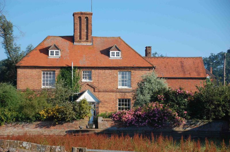
BRADFIELD DARK LANE (south-east side) SU 67 SW 7/3 Barn Elms Farmhouse - II Farmhouse. Dated 1671, with early C19 refenestration and mid C19 wing to east. Red brick with plinth and moulded plat band. Moulded brick eaves cornice to hipped old tile roof with catslide to rear, projecting central stair wing to rear with queen post truss in gable end and large central ridge stack with arched panels. Lobby entrance type. 2 storeys; 3 bays, glazing bar sashes with brick relieving arches above. Central doorway with two 2-panelled doors, moulded surround, and rectangular overlight. C20 brick porch with gabled tile roof. C19 wing to right of red brick with old tile roof and stack off-centre to left. 2 storeys. Segmental headed boarded door to right. Interior: C17 square well 3-flight staircase with turned balusters, and square newels with ball finials.
Listing NGR: SU6068873358
External links are from the relevant listing authority and, where applicable, Wikidata. Wikidata IDs may be related buildings as well as this specific building. If you want to add or update a link, you will need to do so by editing the Wikidata entry.


Other nearby listed buildings