Latitude: 51.4724 / 51°28'20"N
Longitude: 0.0157 / 0°0'56"E
OS Eastings: 540095
OS Northings: 176757
OS Grid: TQ400767
Mapcode National: GBR LW.W3L
Mapcode Global: VHHNQ.7852
Plus Code: 9F32F2C8+X7
Entry Name: Christ's College Preparatory School
Listing Date: 8 June 1973
Grade: II
Source: Historic England
Source ID: 1289913
English Heritage Legacy ID: 396176
ID on this website: 101289913
Location: Greenwich, London, SE3
County: London
District: Greenwich
Electoral Ward/Division: Blackheath Westcombe
Parish: Non Civil Parish
Built-Up Area: Greenwich
Traditional County: Kent
Lieutenancy Area (Ceremonial County): Greater London
Church of England Parish: Kidbrooke
Church of England Diocese: Southwark
Tagged with: School building
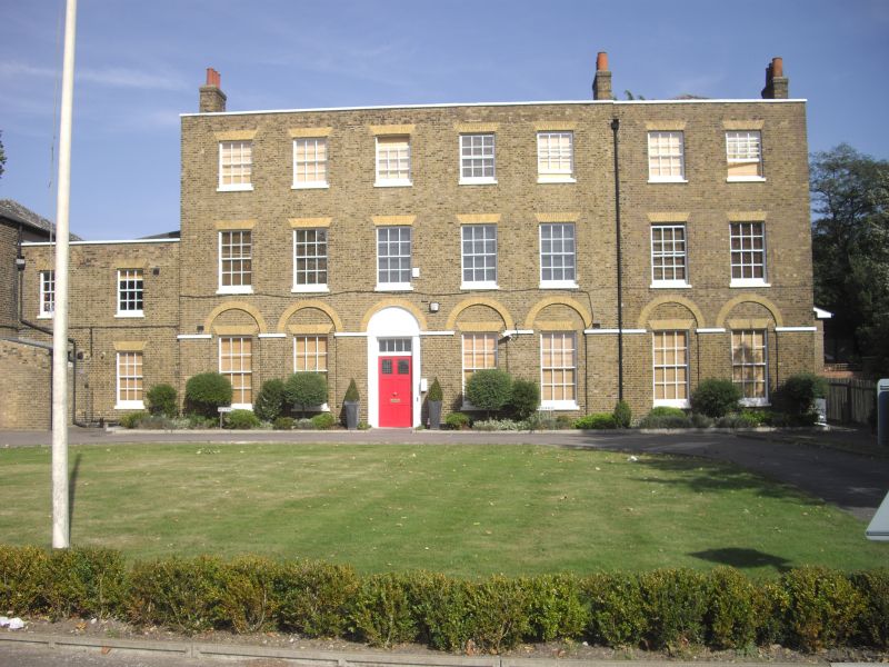
ST GERMAN'S PLACE SE3 1. 4412 No 4 (Christ's College Preparatory School) TQ 4076 39/G113 II 2. Early C19 building of 3 storeys, 3 windows. Multicoloured stock brick with parapet concealing slated roof of moderately low pitch, wmth ridge ends to road. Gauged, flat brick arches to recessed sash windows,some with glazing bars, many replaced. Arcaded ground floor with stuccoed impost band; but windows within arched recesses are flat headed. Door of 6 panels (2 glazed) in 3rd bay from left. Cornice head and plain rectangular fanlight, panelled reveal. Doorcase of reeded pilasters and fluted stucco fan above. Long; 2 storey left extensions.
Listing NGR: TQ4009576757
External links are from the relevant listing authority and, where applicable, Wikidata. Wikidata IDs may be related buildings as well as this specific building. If you want to add or update a link, you will need to do so by editing the Wikidata entry.


Other nearby listed buildings