Latitude: 53.3879 / 53°23'16"N
Longitude: -3.0268 / 3°1'36"W
OS Eastings: 331803
OS Northings: 388383
OS Grid: SJ318883
Mapcode National: GBR 7Y98.H8
Mapcode Global: WH87D.G3WM
Plus Code: 9C5R9XQF+47
Entry Name: Fearnley
Listing Date: 28 February 1975
Grade: II
Source: Historic England
Source ID: 1291684
English Heritage Legacy ID: 389360
ID on this website: 101291684
Location: Wirral, Merseyside, CH41
County: Wirral
Electoral Ward/Division: Birkenhead and Tranmere
Parish: Non Civil Parish
Built-Up Area: Birkenhead
Traditional County: Cheshire
Lieutenancy Area (Ceremonial County): Merseyside
Church of England Parish: Birkenhead Christ the King
Church of England Diocese: Chester
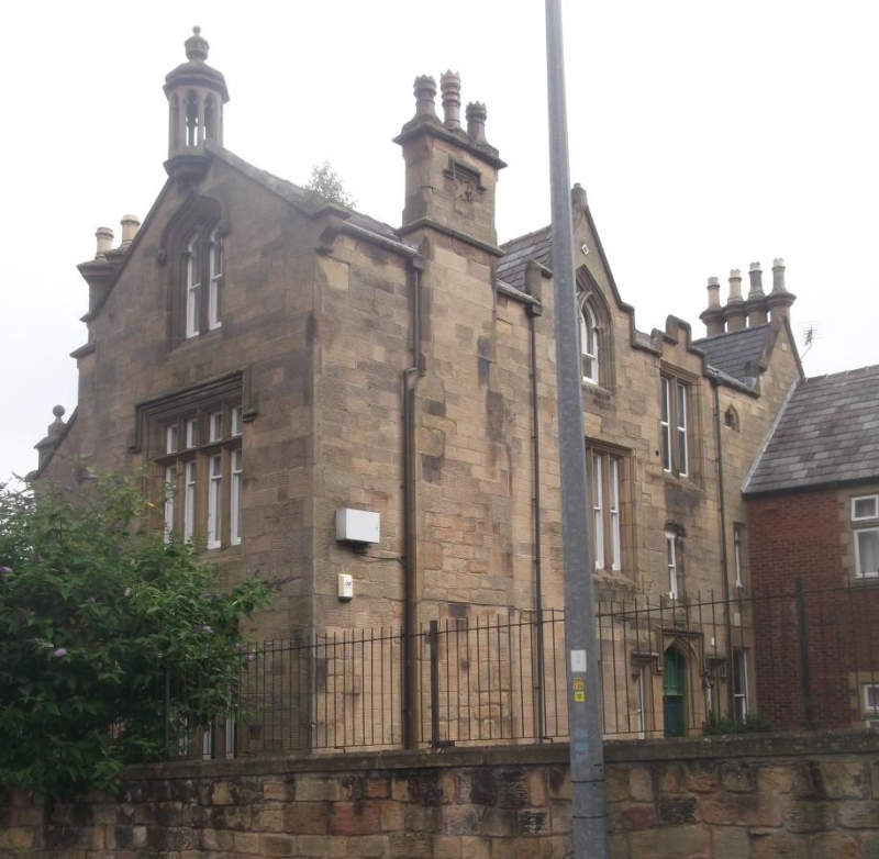
BIRKENHEAD
SJ3188 THE WOODLANDS
789-1/11/149 (South side)
28/02/75 No.42
Fearnley
GV II
Formerly known as: Fearnley Hall THE WOODLANDS.
House, now subdivided. Dated 1843. By Walter Scott.
Ashlar-faced with Welsh slate roof. 2 storeys with attics, the
plan comprising one long range with a shorter parallel front
range and gabled wing. Entrance in angle of rear range and
wing, a gabled canted porch with 4-centred arched doorway with
hood-mould and decoration in the spandrels. Tier of windows in
side wall of wing, with stepped hood mould over 3-light
mullioned window of first floor and traceried window in dormer
above. Expressed chimney corbelled out on gable wall, with
date in shield and 3 diagonal flues. 3-window range to front
range, with 2 bays expressed by gabled dormers over, each with
3-light mullioned window, and a narrower bay against the wing.
Return elevation to Fearnley Street has 4-light mullioned and
transomed window on each floor beneath gabled dormer, and
octagonal lantern turret over. Forms part of the original
development of Clifton Park, laid out by Scott in the early
1840's.
Listing NGR: SJ3180388383
External links are from the relevant listing authority and, where applicable, Wikidata. Wikidata IDs may be related buildings as well as this specific building. If you want to add or update a link, you will need to do so by editing the Wikidata entry.


Other nearby listed buildings