Latitude: 53.3885 / 53°23'18"N
Longitude: -3.0254 / 3°1'31"W
OS Eastings: 331901
OS Northings: 388447
OS Grid: SJ319884
Mapcode National: GBR 7Y98.T1
Mapcode Global: WH87D.H3K5
Plus Code: 9C5R9XQF+9R
Entry Name: 57 59, the Woodlands
Listing Date: 28 March 1974
Grade: II
Source: Historic England
Source ID: 1291688
English Heritage Legacy ID: 389362
ID on this website: 101291688
Location: Birkenhead, Wirral, Merseyside, CH41
County: Wirral
Electoral Ward/Division: Birkenhead and Tranmere
Parish: Non Civil Parish
Built-Up Area: Birkenhead
Traditional County: Cheshire
Lieutenancy Area (Ceremonial County): Merseyside
Church of England Parish: Birkenhead Christ the King
Church of England Diocese: Chester
BIRKENHEAD
SJ3188 THE WOODLANDS 789-1/11/151 (North side) 28/03/74 Nos.57 AND 59
GV II
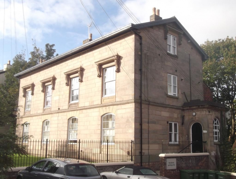
Pair of houses. c1840. Possibly by Walter Scott. Ashlar-faced with Welsh slate roof. 2 storeys, each unit a 2-bay plan with side entrance. Projecting single-storey porch each side with round-arched doorways up steps. Rusticated ground floor with segmental arched 16-pane sash windows arched windows with stressed voussoirs and recessed panels below. 9-pane sash windows above, in stressed architraves with entablatures carried on brackets. Continuous sill band. Moulded eaves cornice, overhanging eaves and axial stacks. Forms part of the original development of Clifton Park, laid out by Scott in the early 1840's.
Listing NGR: SJ3190188447
External links are from the relevant listing authority and, where applicable, Wikidata. Wikidata IDs may be related buildings as well as this specific building. If you want to add or update a link, you will need to do so by editing the Wikidata entry.


Other nearby listed buildings