Latitude: 54.1169 / 54°7'0"N
Longitude: -1.5637 / 1°33'49"W
OS Eastings: 428617
OS Northings: 469090
OS Grid: SE286690
Mapcode National: GBR KNJT.8Z
Mapcode Global: WHC7T.YSK9
Plus Code: 9C6W4C8P+QG
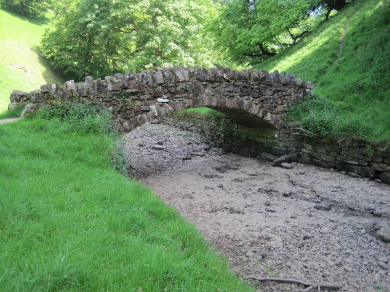
Entry Name: Rustic Bridge over River Skell Approximately 500 Metres South-East of the Outlet from the Lake, with Ford Approximately 4 Metres to North
Listing Date: 11 June 1986
Grade: II
Source: Historic England
Source ID: 1296077
English Heritage Legacy ID: 331067
ID on this website: 101296077
Location: North Yorkshire, HG4
County: North Yorkshire
District: Harrogate
Civil Parish: Lindrick with Studley Royal and Fountains
Traditional County: Yorkshire
Lieutenancy Area (Ceremonial County): North Yorkshire
Tagged with: Bridge
SE 2869
9/63
LINDRICK WITH STUDLEY ROYAL AND FOUNTAINS
STUDLEY PARK
Rustic Bridge over River Skell approximately 500 metres south-east of the outlet from the Lake, with ford approximately 4 metres to north
GV
II
Ford and bridge. Ford c1740 for John Aislabie, bridge probably before 1781
for William Aislabie. Ford: gritstone setts flanked by curbstones.
Approximately 3 metres wide, partly collapsed and silted over at time of
resurvey. For further details see ford 150 metres south-east of Lake
outlet. Bridge: gritstone rubble and boulders, with tufa blocks. Single-
span shallow segmental arch with dressed rubble voussoirs. Rubble crest to
parapet, large boulders to terminals. The stones are mortared but carefully
built up to give the appearance of dry walling. The bridge carries a narrow
bridle or pedestrian pathway and replaced one of c1740 built in a Chinese
Chippendale style, (W T C Walker, personal communication). The route led to
the pagoda in the Chinese Wood further east (demolished).
Listing NGR: SE2861769090
External links are from the relevant listing authority and, where applicable, Wikidata. Wikidata IDs may be related buildings as well as this specific building. If you want to add or update a link, you will need to do so by editing the Wikidata entry.


Other nearby listed buildings