Approximate Location Map
Large Map »
Latitude: 51.1478 / 51°8'52"N
Longitude: -2.7162 / 2°42'58"W
OS Eastings: 350001
OS Northings: 138973
OS Grid: ST500389
Mapcode National: GBR MK.7XB3
Mapcode Global: VH8B3.VDYX
Plus Code: 9C3V47XM+4G
Entry Name: Walls and Gatepiers to St John's Churchyard
Listing Date: 15 March 1974
Grade: II
Source: Historic England
Source ID: 1296716
English Heritage Legacy ID: 265927
ID on this website: 101296716
Location: Glastonbury, Somerset, BA6
County: Somerset
District: Mendip
Civil Parish: Glastonbury
Built-Up Area: Glastonbury
Traditional County: Somerset
Lieutenancy Area (Ceremonial County): Somerset
Tagged with: Wall
1.
1133 HIGH STREET
(North Side)
Walls and gatepiers
to St John's churchyard
ST 4939 5/6a
ST 4938 7/6a
ST 5038 8/6a
II GV
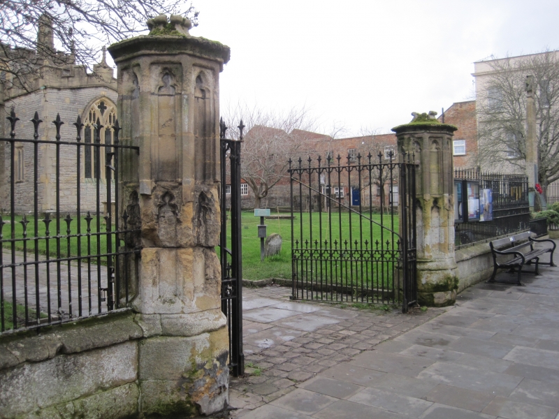
2.
2 gate piers at south entrance to churchyard. About 1860. Ashlar. Approx 8/10 ft high. Each of 10 sides, with cornice and pyramidal top having crenellations. Gothic panelled sides. Both piers are attached to low walls, formerly supporting railings around churchyard. Ashlar with plinth and coping. A further pier with coped top stands attached to the wall, opposite the west door of the church.
The listed buildings from No. 25 to No 31 (North side) form an important group with No 2 Church Lane.
Listing NGR: ST4997639005
External links are from the relevant listing authority and, where applicable, Wikidata. Wikidata IDs may be related buildings as well as this specific building. If you want to add or update a link, you will need to do so by editing the Wikidata entry.


Other nearby listed buildings
