Latitude: 52.0546 / 52°3'16"N
Longitude: -2.7116 / 2°42'41"W
OS Eastings: 351303
OS Northings: 239823
OS Grid: SO513398
Mapcode National: GBR FL.DN0R
Mapcode Global: VH85N.YMC8
Plus Code: 9C4V373Q+V9
Entry Name: Marbury House
Listing Date: 10 June 1952
Grade: II
Source: Historic England
Source ID: 1297423
English Heritage Legacy ID: 372462
ID on this website: 101297423
Location: Portfields, County of Herefordshire, HR1
County: County of Herefordshire
Civil Parish: Hereford
Built-Up Area: Hereford
Traditional County: Herefordshire
Lieutenancy Area (Ceremonial County): Herefordshire
Church of England Parish: St Peter with St Owen and St James, Hereford
Church of England Diocese: Hereford
Tagged with: House
HEREFORD
SO5139NW ST OWEN STREET 683-1/7/274 (South side) 10/06/52 No.38 Marbury House
GV II
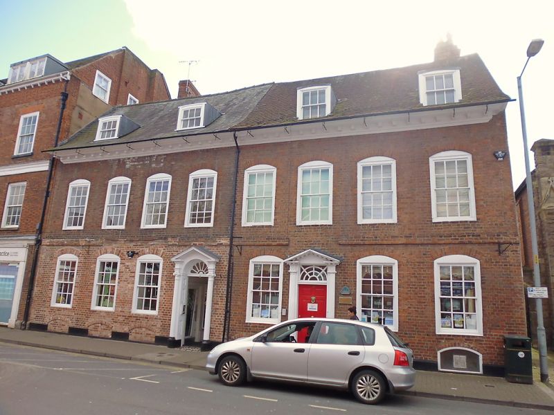
Formerly known as: No.119 ST OWEN STREET. House, now shops and offices. Early C18, with C19 wing to rear. Brick; stucco plinth; plain tile roof; brick end stack to right. Double-depth plan. 2 storeys and attic; 4-window range: 6/6 sashes in moulded cases under segmental arches; moulded wood modillioned eaves; C19(?) roof dormers with 3/3 sashes. Entrance to centre left: C18 six-panel door and fanlight in plain wood case, with modillioned open pediment hood with round pilasters; three 6/6 sashes in moulded cases under segmental arches; brick band interrupted over hood. INTERIOR: early C18 open-well staircase with moulded string and rail, and turned balusters. Attic: 4 plank doors. 1st floor: three C19 four-panel doors; C18 corner fireplace; 4-panel doors; late C19 fireplace; stick baluster staircase to ground floor. Ground floor: wing to rear: late C19/early C20 fireplace. Cellar: plank door.
Listing NGR: SO5130339823
External links are from the relevant listing authority and, where applicable, Wikidata. Wikidata IDs may be related buildings as well as this specific building. If you want to add or update a link, you will need to do so by editing the Wikidata entry.
Other nearby listed buildings