Latitude: 54.0535 / 54°3'12"N
Longitude: -2.8052 / 2°48'18"W
OS Eastings: 347384
OS Northings: 462250
OS Grid: SD473622
Mapcode National: GBR 8PVK.HP
Mapcode Global: WH846.WCCV
Plus Code: 9C6V353V+CW
Entry Name: 23, St Georges Quay
Listing Date: 18 February 1970
Grade: II
Source: Historic England
Source ID: 1298307
English Heritage Legacy ID: 383298
ID on this website: 101298307
Location: Lancaster, Lancashire, LA1
County: Lancashire
District: Lancaster
Electoral Ward/Division: Castle
Parish: Non Civil Parish
Built-Up Area: Lancaster
Traditional County: Lancashire
Lieutenancy Area (Ceremonial County): Lancashire
Church of England Parish: Lancaster St Mary with St John and St Anne
Church of England Diocese: Blackburn
Tagged with: Building
LANCASTER
SD4762 ST GEORGE'S QUAY 1685-1/3/264 (South West side) 18/02/70 No.23
GV II
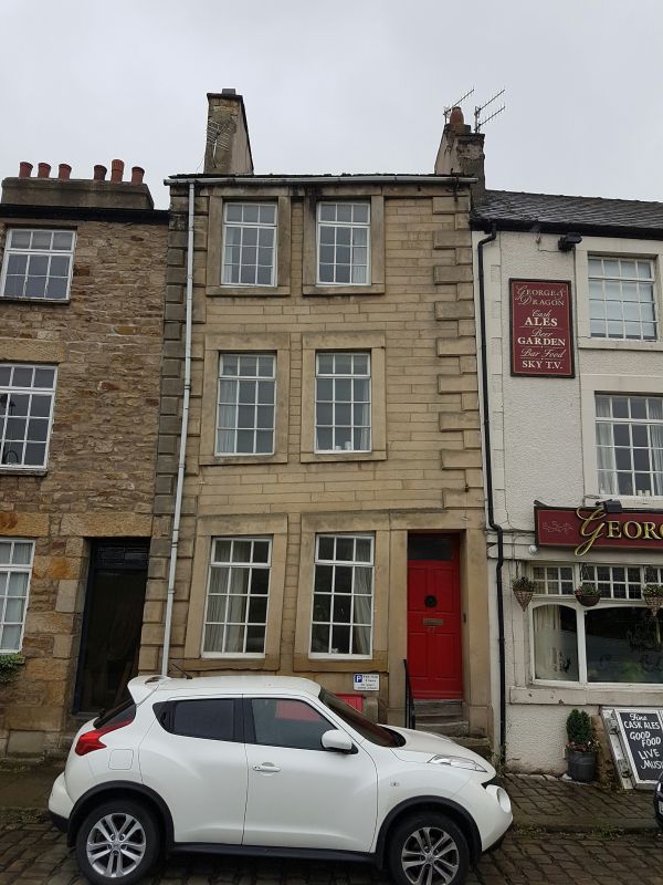
House. Late C18, altered C20. Sandstone squared and dressed into large stones, with ashlar dressings, and a slate roof. Double-depth plan. Facade has chamfered quoins and is of 3 storeys above a cellar and 2 closely-spaced bays. Windows are later C20 timber casements with plain stone surrounds. In the left-hand bay there is a blocked cellar opening. In the right-hand bay is a trap door between stone reveals, projecting forwards at an angle of about 45 degrees to the vertical. At the right 4 external steps lead to a door recessed within a plain stone surround. It has a glazed panel above 4 raised and fielded panels. Chimneys to left and right. The house was built on made-up ground behind the quay wall and the left-hand gable wall seems to have subsided badly shortly after construction. The distortion is particularly noticeable in the window lintels, which are far from being horizontal.
Listing NGR: SD4738462250
External links are from the relevant listing authority and, where applicable, Wikidata. Wikidata IDs may be related buildings as well as this specific building. If you want to add or update a link, you will need to do so by editing the Wikidata entry.


Other nearby listed buildings