Latitude: 51.9239 / 51°55'25"N
Longitude: -2.1214 / 2°7'16"W
OS Eastings: 391749
OS Northings: 225044
OS Grid: SO917250
Mapcode National: GBR 1KK.BH3
Mapcode Global: VH941.5XW1
Plus Code: 9C3VWVFH+GC
Entry Name: Uckington Farmhouse
Listing Date: 25 February 1987
Grade: II
Source: Historic England
Source ID: 1303770
English Heritage Legacy ID: 134612
ID on this website: 101303770
Location: Uckington, Tewkesbury, Gloucestershire, GL51
County: Gloucestershire
District: Tewkesbury
Civil Parish: Uckington
Traditional County: Gloucestershire
Lieutenancy Area (Ceremonial County): Gloucestershire
Church of England Parish: Elmstone Hardwicke St Mary Magdalene
Church of England Diocese: Gloucester
Tagged with: Farmhouse
SO 92 NW UCKINGTON UCKINGTON VILLAGE
7/204 Uckington Farmhouse
GV II
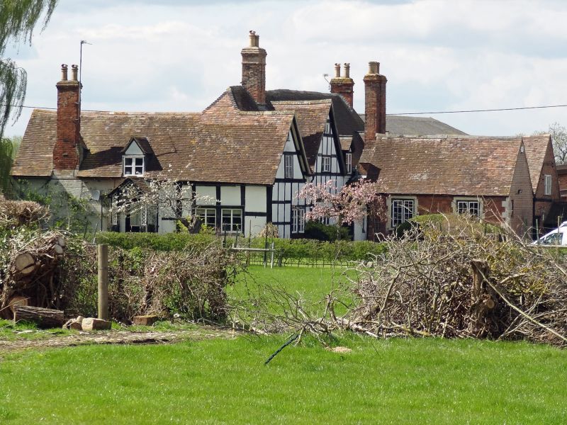
Farmhouse. C17 and early C19. C17 range, square-panelled timber framing with painted brick infill. Early C19 extensions in brick (mostly painted). Red tile roof. Brick stacks. 'L'- shaped plan to the C17 range with successive C19 extensions and outbuildings to the right of the gable end and rear left of C17 range. C17 range; two storeys and attic. Twin-gabled entrance front. Left-hand gable restored in 1980. Fenestration comprises single-light 2 and 3-light casements mostly with horizontal glazing bars. Plank door to lean-to porch to C19 extensions projecting forwards to right. Principal C19 range 2 storeys and attic with C20 two and 3-light dormers from the eaves. Two and 3-light casements with blind segmental-heads to the ground floor. Sawtooth and dentils decoration at eaves of successive C19 extension. Twin off-the-ridge stack to C17 range. Gable-end and lateral stacks. Interior not inspected.
Listing NGR: SO9174925044
External links are from the relevant listing authority and, where applicable, Wikidata. Wikidata IDs may be related buildings as well as this specific building. If you want to add or update a link, you will need to do so by editing the Wikidata entry.


Other nearby listed buildings