Latitude: 53.7081 / 53°42'29"N
Longitude: -0.2256 / 0°13'32"W
OS Eastings: 517218
OS Northings: 424979
OS Grid: TA172249
Mapcode National: GBR VTVK.YH
Mapcode Global: WHHH4.H2S4
Plus Code: 9C5XPQ5F+6Q
Entry Name: Thorngumbald Clough High Lighthouse
Listing Date: 21 May 1987
Grade: II
Source: Historic England
Source ID: 1309912
English Heritage Legacy ID: 166657
Also known as: Thorngumbald Clough High Light
ID on this website: 101309912
Location: East Riding of Yorkshire, HU12
County: East Riding of Yorkshire
Civil Parish: Paull
Traditional County: Yorkshire
Lieutenancy Area (Ceremonial County): East Riding of Yorkshire
Church of England Parish: Paull St Andrew and St Mary
Church of England Diocese: York
Tagged with: Lighthouse
PAULL THORNGUMBALD ROAD TA 12 SE (south-west side, off)
6/11 Thorngumbald Clough High Lighthouse
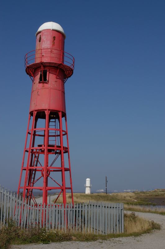
GV II Lighthouse. 1870 for Trinity House. Brick and ashlar base; tower with rivetted wrought-iron frame, casing and balcony; painted red. Drum-shaped base approximately 1 metre high, with rough-faced ashlar top carrying slender tapered round lighthouse tower of 3 stages, overall height approximately 12 metres. Tall first stage: open framework with 8 vertical ribs linked by 6 horizontal bands and a series of inner tension rods bolted to small central hoops. Iron ladder to half-balcony supporting a short ladder up to entrance hatch to second stage with rivetted outer casing. Upper stage has angle struts supporting balcony with plain railings, small door with strap hinges to south, projecting rectangular window to north. Gutter, domed cap with cylindrical ventilator. One of the series of Humber Estuary Lights which included lighthouses at Spurn Point, Easington parish (qv) and South Killingholme (qv), on the south bank. Together with the neighbouring Low Lighthouse to the north (qv), and others at Salt End (now removed), it replaced the lighthouse at Town End Road, Paull (qv). An unusual and innovative design. Still in operation. D Jackson, Lighthouses of England and Wales, 1975, p 105.
Listing NGR: TA1721824979
External links are from the relevant listing authority and, where applicable, Wikidata. Wikidata IDs may be related buildings as well as this specific building. If you want to add or update a link, you will need to do so by editing the Wikidata entry.


Other nearby listed buildings