Latitude: 53.1758 / 53°10'32"N
Longitude: -1.6854 / 1°41'7"W
OS Eastings: 421122
OS Northings: 364346
OS Grid: SK211643
Mapcode National: GBR 585.SVJ
Mapcode Global: WHCDF.2FPQ
Plus Code: 9C5W58G7+8R
Entry Name: Turret House and Attached Railings
Listing Date: 12 July 1967
Grade: II
Source: Historic England
Source ID: 1311493
English Heritage Legacy ID: 81121
ID on this website: 101311493
Location: Youlgreave, Derbyshire Dales, Derbyshire, DE45
County: Derbyshire
District: Derbyshire Dales
Civil Parish: Youlgreave
Built-Up Area: Youlgreave
Traditional County: Derbyshire
Lieutenancy Area (Ceremonial County): Derbyshire
Church of England Parish: Youlgreave All Saints
Church of England Diocese: Derby
20/21 63 PARISH OF YOULGREAVE CHURCH STREET 20/21 64 (North Side) 6/119 Turret House and attached railings
12.7.67 GV II
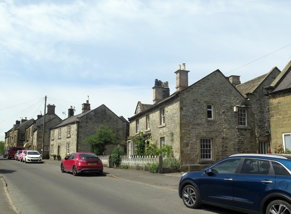
House. C17, refronted mid C19. Coursed limestone rubble with gritstone dressings and quoins. C20 concrete tile roof with stone west gable end stack and central stone ridge stack. Moulded copings with plain kneelers to gables. Plinth and chamfered eaves band. Two storeys, three bays, double range plan. Central chamfered flush doorcase with bracketed moulded stone hood and C19 panelled door. To west side canted bay window with glazing bar sashes, to east glazing bar sash in flush surround. Above, three plain sashes in similar surrounds. West gable wall has blocked C17 2-light recessed and chamfered mullion window with hoodmould. Attached to front, low stone wall with square piers with pointed tops and elaborate iron railings. Included for group value only.
Listing NGR: SK2112264346
External links are from the relevant listing authority and, where applicable, Wikidata. Wikidata IDs may be related buildings as well as this specific building. If you want to add or update a link, you will need to do so by editing the Wikidata entry.


Other nearby listed buildings