Latitude: 52.0127 / 52°0'45"N
Longitude: -0.33 / 0°19'48"W
OS Eastings: 514706
OS Northings: 236236
OS Grid: TL147362
Mapcode National: GBR H51.TMC
Mapcode Global: VHGNC.7NCX
Plus Code: 9C4X2M79+3X
Entry Name: Chapel Farmhouse
Listing Date: 2 January 1985
Grade: II
Source: Historic England
Source ID: 1312576
English Heritage Legacy ID: 37848
ID on this website: 101312576
TL 13NW MEPPERSHALL CHAPEL ROAD 3/59 Chapel Farmhouse
GV II
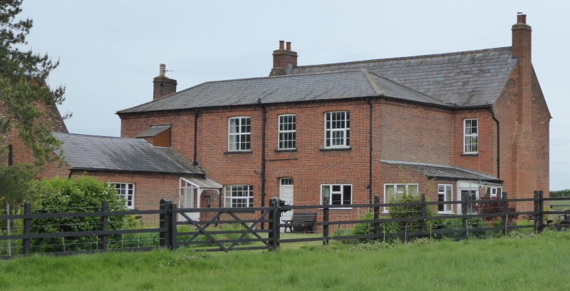
House. On site of the former monastic Grange belonging to Chicksands Priory. Possibly with earlier core, building is late C18 (inscribed brick: "I.H. (or 1.S.?) 1786" with mid-C19 alterations and extensions. Red brick, with vitrified headers to earlier part. Slate roofs, rear block hipped. Principal block is of 2-room plan, 2 storeys and attics, with 2-storeyed block and single-storeyed outbuildings added to rear. W elevation: RH part is original, LH part is C19 addition. Earlier part has brick band at first floor level. Ground and first floors each have 2 C19 tripartite sashes with glazing bars, the LH ground floor one later and larger. First floor has blind window to centre, narrower than other openings. Attic has 2 box dormers. Below blind window is part-glazed door with rectangular fanlight within C19 brick porch. Porch has round-headed arch, and pierced decorative bargeboards. Red brick gable end stacks, one external, one integral. Dentil cornice to eaves.
Listing NGR: TL1470636236
External links are from the relevant listing authority and, where applicable, Wikidata. Wikidata IDs may be related buildings as well as this specific building. If you want to add or update a link, you will need to do so by editing the Wikidata entry.


Other nearby listed buildings