Latitude: 52.248 / 52°14'52"N
Longitude: 0.7122 / 0°42'43"E
OS Eastings: 585248
OS Northings: 264561
OS Grid: TL852645
Mapcode National: GBR QF0.0WL
Mapcode Global: VHKD4.9RCJ
Plus Code: 9F426PX6+6V
Entry Name: 68 and 69, St Johns Street
Listing Date: 12 July 1972
Grade: II
Source: Historic England
Source ID: 1313429
English Heritage Legacy ID: 467275
ID on this website: 101313429
Location: Bury St Edmunds, West Suffolk, IP33
County: Suffolk
District: West Suffolk
Civil Parish: Bury St Edmunds
Built-Up Area: Bury St Edmunds
Traditional County: Suffolk
Lieutenancy Area (Ceremonial County): Suffolk
Church of England Parish: Bury St Edmunds St John the Evangelist
Church of England Diocese: St.Edmundsbury and Ipswich
Tagged with: Building
BURY ST EDMUNDS
TL8564NW ST JOHN'S STREET 639-1/3/611 (East side) 12/07/72 Nos.68 AND 69
GV II
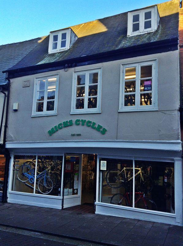
House, later divided into 2 shops, now a single shop with storage above. Early C19 front; older core. Timber-framed and rendered with a coved jetty to the upper storey; steeply-pitched slate roof. EXTERIOR: 2 storeys and attics. 3 window range: long 2-light casements with 2 horizontal glazing-bars to lights in flush moulded architraves. A double C20 shop front with central entry to the ground storey. 2 flat-headed dormers with 2-light casement windows. A long C20 extension at the rear. INTERIOR: no original features visible within the building. The walls of the upper storeys and attics are all covered with vertical tongued and grooved boarding and the ceilings are also boarded. 2 boxed-in main beams in the 1st storey rooms.
Listing NGR: TL8524864561
External links are from the relevant listing authority and, where applicable, Wikidata. Wikidata IDs may be related buildings as well as this specific building. If you want to add or update a link, you will need to do so by editing the Wikidata entry.


Other nearby listed buildings