Latitude: 54.1121 / 54°6'43"N
Longitude: -1.5711 / 1°34'16"W
OS Eastings: 428134
OS Northings: 468555
OS Grid: SE281685
Mapcode National: GBR KNGW.NP
Mapcode Global: WHC7T.VW0Y
Plus Code: 9C6W4C6H+RG
Entry Name: Weir and Reservoir Below Tent Hill
Listing Date: 11 June 1986
Grade: II
Source: Historic England
Source ID: 1315272
English Heritage Legacy ID: 331090
Also known as: Half Moon Reservoir
Half Moon Pond
ID on this website: 101315272
Location: North Yorkshire, HG4
County: North Yorkshire
District: Harrogate
Civil Parish: Lindrick with Studley Royal and Fountains
Traditional County: Yorkshire
Lieutenancy Area (Ceremonial County): North Yorkshire
Tagged with: Reservoir Weir Hydraulic structure
SE 2868 LINDRICK WITH STUDLEY STUDLEY PARK ROYAL AND FOUNTAINS
9/86 Weir and Reservoir below Tent Hill
GV II
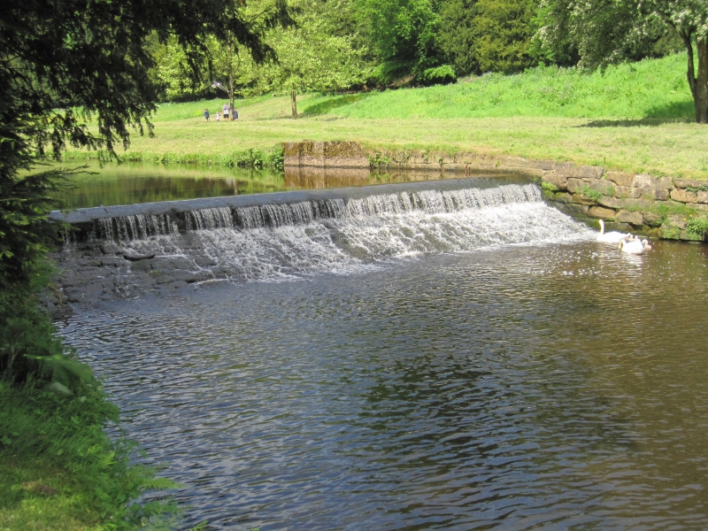
Weir on River Skell, and reservoir shown on map as Half Moon Pond. c1730 for John Aislabie of Studley Park. Gritstone. Weir approximately one metre high, at west end of reservoir which is ox-bow shaped and almost encircles the artificial mound known as Tent Hill. The lining and the flanking walls to the weir and the retaining wall at the base of Tent Hill are included in this listing. The reservoir is the collecting point for the water used in the Canal, Moon, Crescent and Half Moon ponds downstream. Water leaves the reservoir through the culvert at the north-west end and enters the gardens through the arched facade known as the Rustic Bridge (qv). Tent Hill was erected as a back-drop to the gardens and was originally surmounted by the Temple of Venus. The boundary with the parish of Markington with Wallerthwaite passes through the centre of the Reservoir. W T C Walker, personal communication.
Listing NGR: SE2813468555
External links are from the relevant listing authority and, where applicable, Wikidata. Wikidata IDs may be related buildings as well as this specific building. If you want to add or update a link, you will need to do so by editing the Wikidata entry.


Other nearby listed buildings