Latitude: 54.263 / 54°15'46"N
Longitude: -0.8595 / 0°51'34"W
OS Eastings: 474384
OS Northings: 485863
OS Grid: SE743858
Mapcode National: GBR QMF4.QL
Mapcode Global: WHF9V.R3XQ
Plus Code: 9C6X747R+65
Entry Name: Bridge Farmhouse and Attached Outbuildings
Listing Date: 27 August 1987
Grade: II
Source: Historic England
Source ID: 1315677
English Heritage Legacy ID: 382507
ID on this website: 101315677
Location: Sinnington, North Yorkshire, YO62
County: North Yorkshire
District: Ryedale
Civil Parish: Sinnington
Built-Up Area: Sinnington
Traditional County: Yorkshire
Lieutenancy Area (Ceremonial County): North Yorkshire
Tagged with: Farmhouse
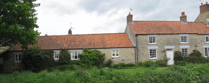
SINNINGTON RIVERSIDE SE 78 NW (west side) 8/89 Bridge Farmhouse and attached outbuildings GV II House and attached outbuildings. Late C18 with C19 refenestration; extended into raised and altered outbuilding to right in C20. Sandy limestone rubble with pantile roofs and brick stacks. Central staircase plan, later extended to right. 2-storey, 3-window front with single-storey range of outbuildings to left. House: door of 6 raised and fielded panels beneath divided overlight, flanked by tall 2-light, small-pane, horizontal-sliding sashes; similar 3-light window inserted in altered right end. 2-light, 12-pane horizontal-sliding sashes to first floor. Painted stone sills to all windows, and painted tooled lintels to all openings, wedge-shaped to ground floor right. End stacks on main building. Range of outbuildings: 2 blocked openings with timber lintels to right of centre; single blocked opening to end left. Small 4-pane light to centre and square shuttered opening to end right. Far left lean-to is not of special interest. House undergoing renovation at time of resurvey.
Listing NGR: SE7438485863
External links are from the relevant listing authority and, where applicable, Wikidata. Wikidata IDs may be related buildings as well as this specific building. If you want to add or update a link, you will need to do so by editing the Wikidata entry.


Other nearby listed buildings