Latitude: 51.559 / 51°33'32"N
Longitude: -0.1791 / 0°10'44"W
OS Eastings: 526327
OS Northings: 186026
OS Grid: TQ263860
Mapcode National: GBR D0.FJV
Mapcode Global: VHGQR.V26Q
Plus Code: 9C3XHR5C+H9
Entry Name: Lamp Post
Listing Date: 11 January 1999
Grade: II
Source: Historic England
Source ID: 1322116
English Heritage Legacy ID: 477519
ID on this website: 101322116
Location: Vale of Health, Camden, London, NW3
County: London
District: Camden
Electoral Ward/Division: Hampstead Town
Parish: Non Civil Parish
Built-Up Area: Camden
Traditional County: Middlesex
Lieutenancy Area (Ceremonial County): Greater London
Church of England Parish: St John Hampstead
Church of England Diocese: London
Tagged with: Streetlight
CAMDEN
TQ2686SW MONEY'S YARD
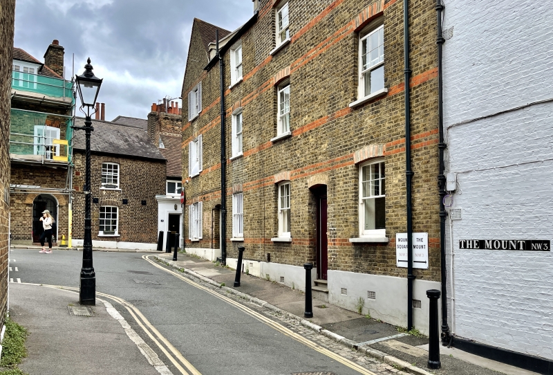
798-1/16/1131 Lamp post
II
Lamp post. C19. Cast-iron. Cannon type base with short column
having ribbed angles and entasis. Windsor lantern.
Listing NGR: TQ2632786026
External links are from the relevant listing authority and, where applicable, Wikidata. Wikidata IDs may be related buildings as well as this specific building. If you want to add or update a link, you will need to do so by editing the Wikidata entry.


Other nearby listed buildings