Latitude: 54.5121 / 54°30'43"N
Longitude: -2.6697 / 2°40'10"W
OS Eastings: 356738
OS Northings: 513178
OS Grid: NY567131
Mapcode National: GBR 9JS8.TB
Mapcode Global: WH81Y.YVWC
Plus Code: 9C6VG86J+R4
Entry Name: Milepost (325 Yards North of Turn to Sleddale)
Listing Date: 24 June 1987
Grade: II
Source: Historic England
Source ID: 1326747
English Heritage Legacy ID: 74157
ID on this website: 101326747
Location: Westmorland and Furness, Cumbria, CA10
County: Westmorland and Furness
District: Eden
Civil Parish: Shap
Built-Up Area: Shap
Traditional County: Westmorland
Lieutenancy Area (Ceremonial County): Cumbria
Church of England Parish: Shap with Swindale St Michael
Church of England Diocese: Carlisle
Tagged with: Milestone
SHAP A6 (West side) NY 51 SE
8/140 Milepost (325 yards north of turn to Sleddale)
II
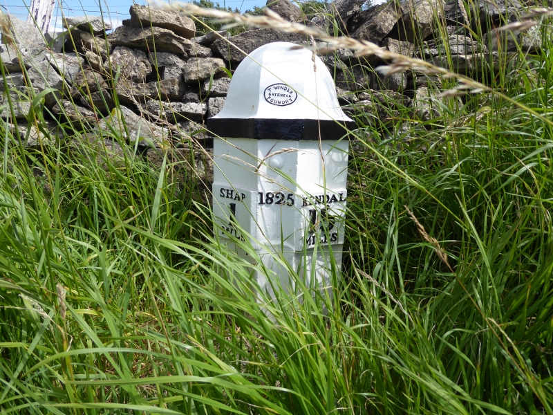
Milepost, dated 1825, for Heron Syke Turnpike Trust. Oval foundry mark on top centre: T. WINDER GATEBECK FOUNDRY. Cast-iron c.3 ft high. 3 concave sides with ogee domical top. Separate plates giving town names and distances in raised letters are fastened to sides of main casting. Left: SHAP 1 MILE. Date to centre. Right: KENDAL 15 MILES. Painted white with lettering, foundry mark, and top edges picked out in black.
Listing NGR: NY5673813178
External links are from the relevant listing authority and, where applicable, Wikidata. Wikidata IDs may be related buildings as well as this specific building. If you want to add or update a link, you will need to do so by editing the Wikidata entry.


Other nearby listed buildings