Approximate Location Map
Large Map »
Latitude: 54.7162 / 54°42'58"N
Longitude: -3.5018 / 3°30'6"W
OS Eastings: 303355
OS Northings: 536722
OS Grid: NY033367
Mapcode National: GBR 3FZX.P5
Mapcode Global: WH5YB.5QRC
Plus Code: 9C6RPF8X+F7
Entry Name: 1, North Quay
Listing Date: 27 May 1977
Grade: II
Source: Historic England
Source ID: 1327133
English Heritage Legacy ID: 71849
ID on this website: 101327133
Location: Maryport, Cumberland, Cumbria, CA15
County: Cumbria
District: Allerdale
Civil Parish: Maryport
Built-Up Area: Maryport
Traditional County: Cumberland
Lieutenancy Area (Ceremonial County): Cumbria
Church of England Parish: Maryport St Mary with Christ Church
Church of England Diocese: Carlisle
Tagged with: House
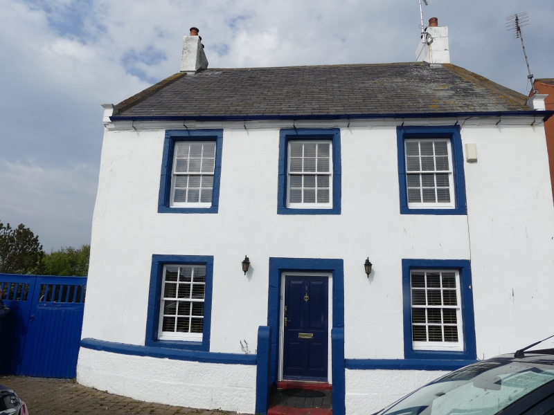
MARYPORT NORTH QUAY
1.
5161 (North-East Side)
-----------------
No 1
NY 0336 1/83
II GV
2.
Late C18. 2 storeys, cement rendered, with Welsh slate roof with coped gable
ends with kneelers and chimney stacks. 3 windows, stone dressings, modern sashes,
cases within reveals. Plain stone dressings to modern door.
Listing NGR: NY0335536722
External links are from the relevant listing authority and, where applicable, Wikidata. Wikidata IDs may be related buildings as well as this specific building. If you want to add or update a link, you will need to do so by editing the Wikidata entry.


Other nearby listed buildings
