Approximate Location Map
Large Map »
Latitude: 50.1908 / 50°11'26"N
Longitude: -5.568 / 5°34'4"W
OS Eastings: 145425
OS Northings: 38403
OS Grid: SW454384
Mapcode National: GBR DXM5.QCB
Mapcode Global: VH053.FGSL
Plus Code: 9C2P5CRJ+8R
Entry Name: Zennor Bridge
Listing Date: 7 September 1988
Grade: II
Source: Historic England
Source ID: 1327288
English Heritage Legacy ID: 70662
ID on this website: 101327288
Location: Zennor, Cornwall, TR26
County: Cornwall
Civil Parish: Zennor
Traditional County: Cornwall
Lieutenancy Area (Ceremonial County): Cornwall
Church of England Parish: Zennor
Church of England Diocese: Truro
Tagged with: Road bridge
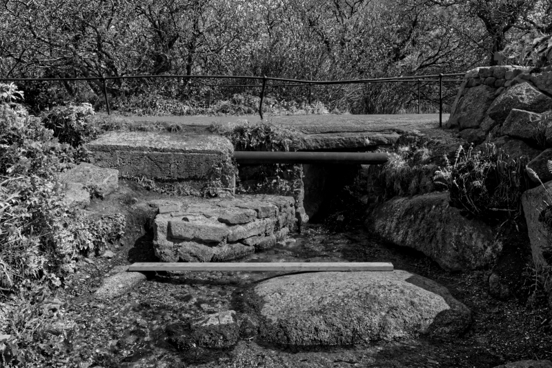
ZENNOR ZENNOR
SW 43 NE
4/342 Zennor Bridge
-
GV II
Road bridge over stream. Circa early-mid C19. Granite rubble and granite lintels.
Iron handrails. Single span bridge of simple lintelled construction. Handrails over
low plinths as parapets are threaded through iron stanchions.
Listing NGR: SW4542538403
External links are from the relevant listing authority and, where applicable, Wikidata. Wikidata IDs may be related buildings as well as this specific building. If you want to add or update a link, you will need to do so by editing the Wikidata entry.


Other nearby listed buildings
