Latitude: 50.2137 / 50°12'49"N
Longitude: -5.2375 / 5°14'14"W
OS Eastings: 169122
OS Northings: 39873
OS Grid: SW691398
Mapcode National: GBR Z3.FM95
Mapcode Global: VH12K.5WJJ
Plus Code: 9C2P6Q77+F2
Entry Name: Stamps Engine House to Wheal Basset Mine at SW 691 398
Listing Date: 12 September 1989
Grade: II
Source: Historic England
Source ID: 1328154
English Heritage Legacy ID: 66676
ID on this website: 101328154
Location: Carnkie, Cornwall, TR16
County: Cornwall
Civil Parish: Carn Brea
Traditional County: Cornwall
Lieutenancy Area (Ceremonial County): Cornwall
Church of England Parish: Redruth
Church of England Diocese: Truro
Tagged with: Chimney
CARN BREA CARNKIE SW 63 NE 8/128 Stamps engine house to Wheal Basset Mine at SW 691 398
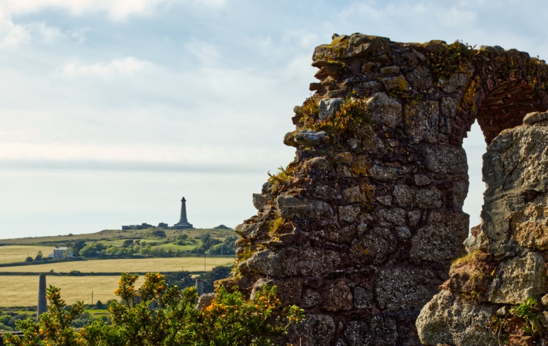
GV II Double stamps engine house to former tin mine, now derelict. Dated 1868 on bob wall; altered. Uncoursed granite rubble with quoins, bob wall of granite blocks, window arches of brick; former 2-span roof now missing. Built on a raised terrace running east-west, overlooking dressing floor on north side. Rectangular plan on north-south axis, with bob wall to north and foundations of former flywheel below and in front of this. Two stages, with round-headed openings including 2 driver's windows in bob wall; above these windows, 2 stones with inscriptions in sunk panels: "W.B." and "1868"; side walls and rear damaged. History: built to contain 2 single-acting 30-inch beam engines mounted side by side and connected to a common flywheel, driving three 16-heads stamps, subsequently increased to 96 heads; worked for 50 years, and was then modified to act as ore hopper for re-working dumps. Prominent element of group conspicuously sited on northern slope of Carnmenellis. Reference: Palmer & Neaverson, op.cit.
Listing NGR: SW6910039800
External links are from the relevant listing authority and, where applicable, Wikidata. Wikidata IDs may be related buildings as well as this specific building. If you want to add or update a link, you will need to do so by editing the Wikidata entry.


Other nearby listed buildings